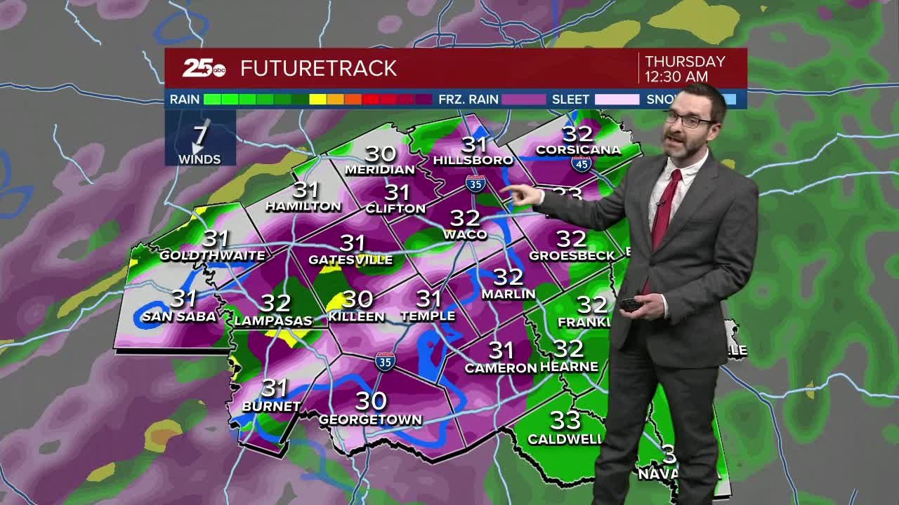


CENTRAL TEXAS — The Winter Storm WARNING has been extended into Thursday morning. The highest impacts will be from Waco/Temple/Killeen, north and west, but some icing is possible across our southeastern counties. The Winter Storm Warning has been upgraded to an ICE STORM WARNING for Bosque, Mills, and Hamilton counties. This is where ice totals could total close to an inch.
WEDNESDAY: Another round of freezing rain is likely. This batch could be the heaviest we have seen so far. Roads will be icy, especially in the morning hours. We will start to see a bit more collect on trees and powerlines as well. Temperatures will slowly warm into the low 30s.
WEDNESDAY NIGHT: Areas of freezing rain will continue, especially from Waco/Temple/Killeen, north and west. Temperatures may climb above freezing southeast of this area during the night.
THURSDAY: Rain and freezing rain are possible during the morning hours, but we should see most of the area get above freezing Thursday afternoon.
THURSDAY NIGHT/FRIDAY MORNING: Expect icy spots during the morning commute as temperatures fall back below freezing overnight.
FRIDAY: Ice will melt most of the way as temperatures climb to the 50s.
Stay tuned for updates through the day.
Meteorologist Josh Johns
25 Weather
