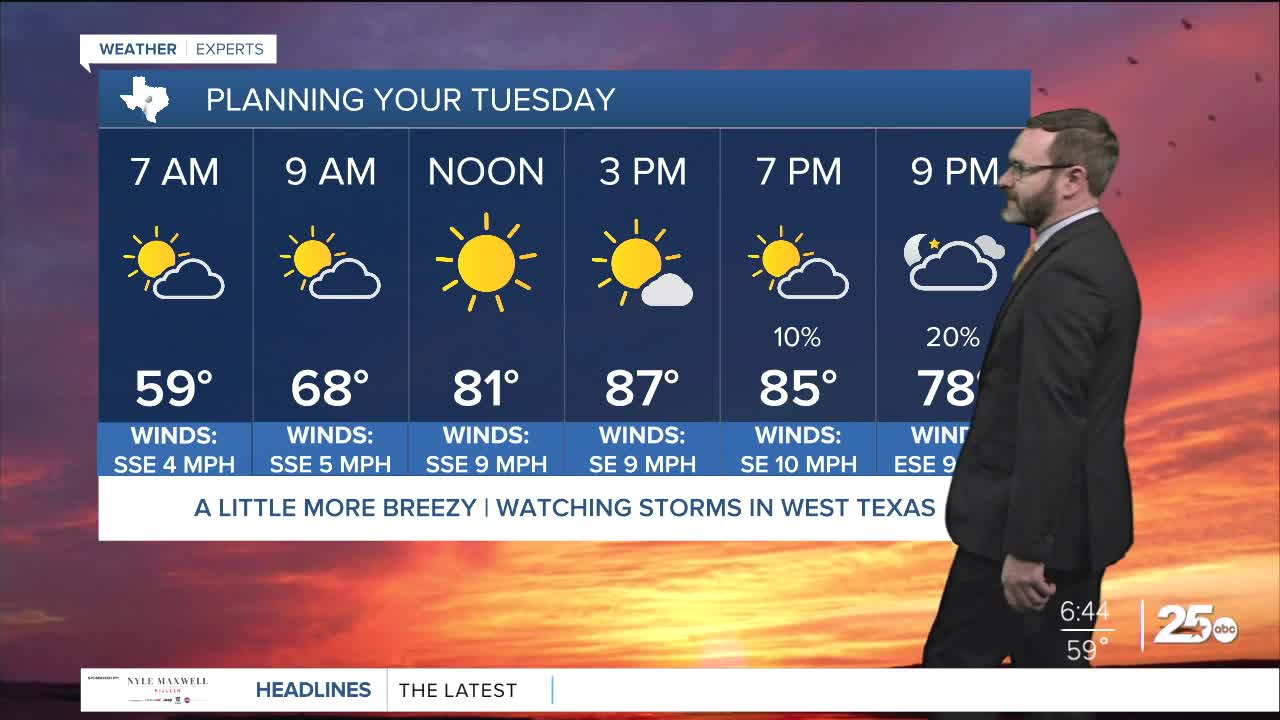


CENTRAL TEXAS — Highs will climb into the upper 80s this afternoon with partly cloudy skies. A stray storm will be possible in the afternoon, with storm chances west of I-35 overnight. Chances linger this week.
THE BREAKDOWN:
- Storm chances start today, with the best chances overnight west of I-35.
- Chances linger through the week with lots of uncertainty in location and timing.
- Temperatures remain above normal.
- There could be a better storm threat next week.
Good morning! We're waking up to a more muggy start to the day, with some patchy fog working into areas along and east of I-35. This is the signs of moisture increasing across our area which will fuel storm chances this week. The first storm chance will occur today with some isolated storms possible in the warm and muggy air, and storms over West Texas this afternoon that could work into areas west of I-35 overnight. These will be weakening as they do so, which means the severe threat will be rather low.
A lot of the uncertainty in the forecast this week depends on placement of boundaries. The main boundary will be the dry line, which will stay west of our area triggering storms over West Texas. Storms may try to build into complexes and work east into our area in a dying state. Sometimes that can leave boundaries around that can trigger shower and storms in the afternoon. Models will struggle to pick up on timing and location with these, so for now we only have chances around 40% both Wednesday and Thursday. Where storms hit, some areas may pick up a half inch or so - but widespread rains are not expected.
The weekend looks quiet, but next week could bring a more substantial threat for storms. Stay tuned!
Have a great Tuesday!
Meteorologist Josh Johns
25 Weather
