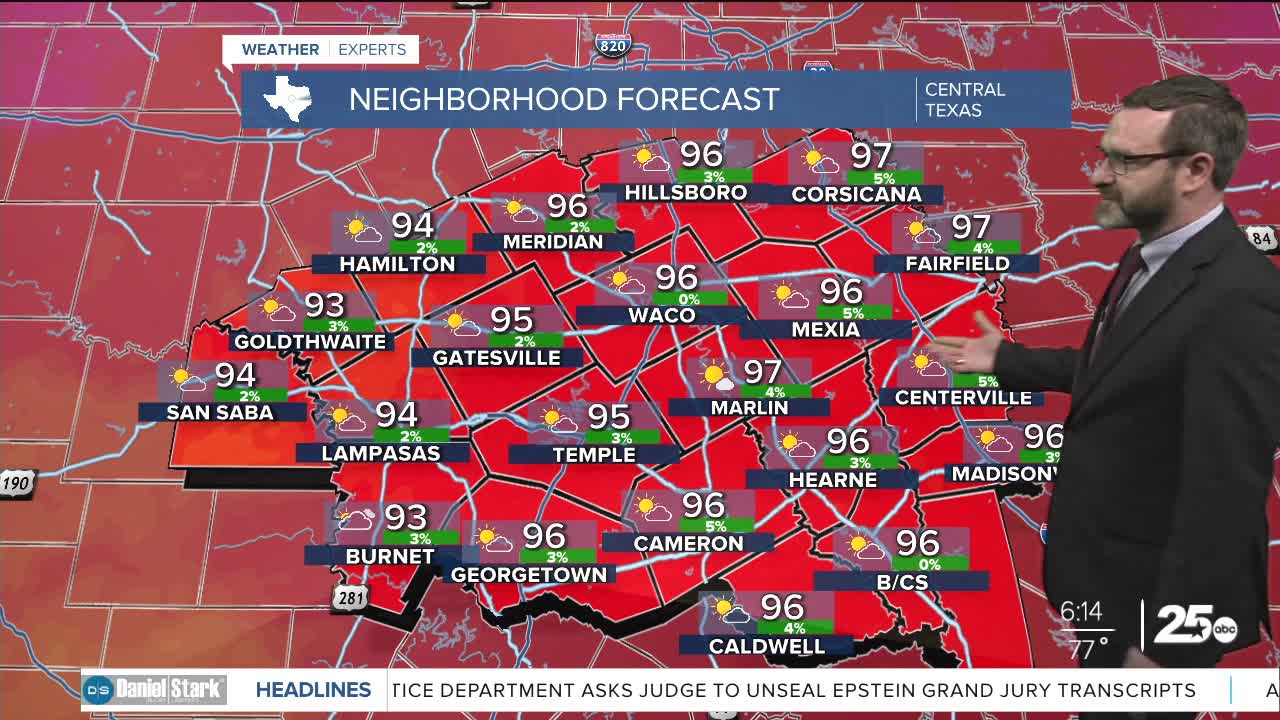


CENTRAL TEXAS — Highs will climb into the mid 90s today, but humidity will make it feel closer to 100. We'll see building temperatures into the middle of the week.
THE BREAKDOWN:
- Staying warm and humid Monday.
- High pressure builds bringing more heat.
- Small chance of showers this weekend.
Good morning! The system that brought some showers this weekend is on the way out, so the only place that may see a shower is west of I-35, but it's a very low chance. Otherwise, expect a hot and humid day with highs in the mid 90s and feel-like temperatures that may reach the triple digits in many locations. We'll have a south breeze keeping things humid at about 15- 20mph.
High pressure builds through the middle of the week, slowly inching temperatures into the upper 90s. Our hottest temperatures will likely occur from the mid-week into the end of the week. That may lower humidity a hair, but won't make a huge difference.
Heading into the weekend, our high may jog north a bit allowing a tropical wave to move in. That could bring some small rain chances for the weekend, and will also dampen your plans if you're traveling to the coast. Rain chances look small at this time.
Have a great Monday!
Meteorologist Josh Johns
25 Weather
