

CENTRAL TEXAS — Clouds and mist will be around to start Friday with showers and storms possible later this afternoon and especially in the evening and overnight hours. Some of these storms may contain gusty winds.
THE BREAKDOWN:
- Cloudy and misty to start the day.
- Showers and storms will be possible this afternoon and evening into the overnight hours with some severe storms possible.
- A quieter weekend is on the way with cooler air to start off next week.
We're waking up to some misty drizzle this morning across Central Texas, which will be slow to clear this morning. Expect showers and storms to develop later this afternoon into the nighttime hours. If we can see some sunshine this afternoon, we could see some storms tap into more energy. These storms would carry a hail threat, but are not a certainty.
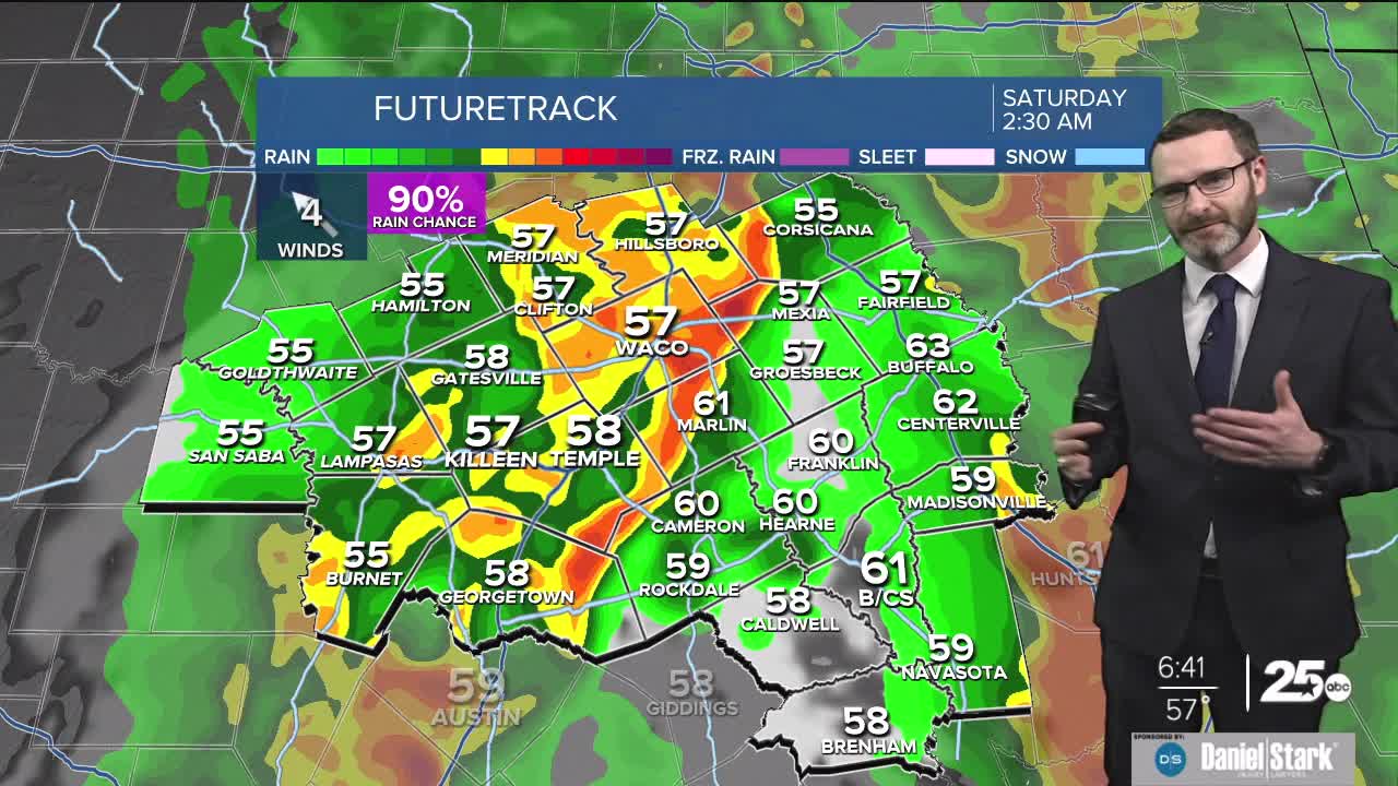
Our best chances of rain arrive overnight with a complex of showers and storms expected to work in from the west. If we get a line of storms to develop and come through, these could carry a gusty wind threat with winds to 60mph possible in some isolated areas of the line. It's not a *huge* severe weather threat, but one we need to monitor. Keep your phone on loud tonight, and we will let you know if anything flares up. The good news is all activity should be out of here by Saturday morning, and this won't feature flooding rainfall like last week.
A drier day is expected for Saturday and Sunday with highs in the 60s. Gusty winds arrive Sunday and Monday with winds to 25mph possible out of the northwest. This will also lead to high cedar pollen counts.
Most of next week will be quiet, but we are watching for more rain chances to work in next weekend!
Have a great Friday and a wonderful weekend!
Meteorologist Josh Johns
25 Weather
