

CENTRAL TEXAS — A weak cold front will provide enough lift for showers and storms today. Temperatures should be a bit lower, but will still feel hot with the humidity.
THE BREAKDOWN:
- Rain chances return today.
- Slightly cooler for the weekend.
- Next week we return to the big heat.
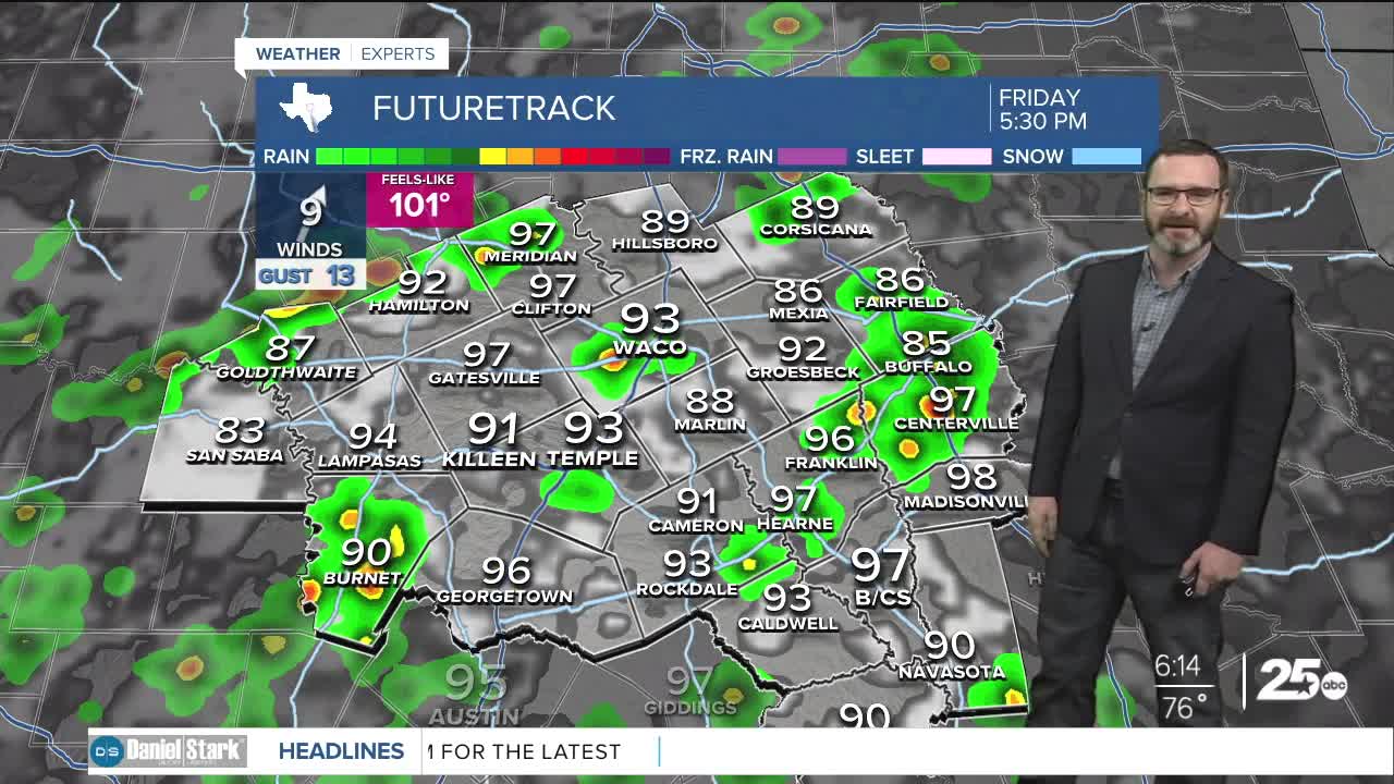
Good morning! Yesterday marked the second triple digit day of 2025, and the hottest of the year as we climbed to 102. I don't see a repeat of that today, though it will still be hot. We are tracking a cold front sagging south into our area this afternoon. While we won't see a big cool-down from it, it will provide enough lift for showers and storms this afternoon. I don't expect widespread heavy rain or flooding, but some of these storms could have heavy downpours. That may lead to street flooding in spots for the afternoon commute. We'll see highs in the upper 90s, but with higher humidity, it will still feel like the triple digits. Activity should die down later tonight as we lose the heating of the day.
Some showers will still be possible this weekend, with low to mid 90s on the way for Saturday and Sunday. Monday may bring a greater chance of rain, as we'll see our upper-level ridge build to the west. Disturbances like to rotate long the edge of that, and models are being pretty consistent on bringing one of those during the first half of the day Monday. This could lead to a round of showers and storms. After that, the ridge takes over for most of next week, pushing highs back close to 100 and drying us out.
Have a great Friday!
Meteorologist Josh Johns
25 Weather
