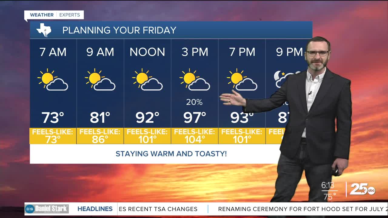


CENTRAL TEXAS — Highs will climb into the upper 90s this afternoon under partly cloudy skies. A few areas will see some afternoon showers, with the best chances in the Brazos Valley.
THE BREAKDOWN:
- Dangerous afternoon heat still an issue.
- Some may see showers today - best chances in the Brazos Valley.
- More rain chances Saturday.
- Hot again early next week.
Good morning! It's setting up to be another hot day with highs in the upper 90s. With the humidity, it will feel closer to 105 in many locations. A heat advisory is in place for the I-45 counties again. Dangerous heat will be possible in the afternoon hours again. Be sure to limit time outside, drink plenty of water, and if you have to be outside in the heat of the day - take frequent breaks in the shade. A few areas will see showers this afternoon as a tropical wave moves into southeast Texas. The best chance for seeing rain will be across the Brazos Valley and east of I-35. Activity will be rather isolated.
Saturday, with the moisture in place, highs should stay in the low to mid 90s. Still, it will feel like 100 or higher in many locations. Expect more coverage of showers on Saturday, though activity will only be scattered, with a good chunk of folks still missing out. Any activity will die down after sunset.
Sunday could still feature some isolated showers, but high pressure will re-establish itself into early next week bringing back upper 90s. High pressure should back off again heading into the second half of next week which may allow another tropical wave to work in. Stay tuned!
Have a great Friday!
Meteorologist Josh Johns
25 Weather
