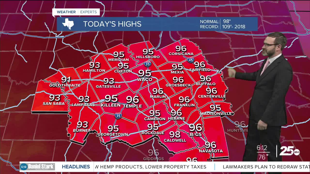


CENTRAL TEXAS — Clouds will be around to start the day, with some sprinkles even possible west of I-35. Clouds should break giving way to another hot afternoon with highs in the mid 90s.
THE BREAKDOWN:
- Some sprinkles will be possible this morning west of I-35.
- Heat still the big story with highs in the mid 90s feeling like the triple digits.
- Heat increases, but weekend brings small rain chances.
Good morning! We're waking up to another humid start with morning lows in the mid 70s. A few showers are showing up west of I-35, but these are falling into very dry air, so at most I only expect some sprinkles or light rain to be possible in the early morning hours west of I-35. That activity will fall apart and clouds will slowly break this afternoon allowing temperatures to get into the mid 90s. When you factor in the humidity, it will feel closer to 100-105.
High pressure builds over us for the second half of this week pushing temperatures higher into the upper 90s. At the base of this high, a tropical wave will be traveling over the Gulf to the west. That may bring small rain chances Friday and Saturday as it crosses into the Texas Coast. This will also knock highs back into the mid 90s. Once that gets out of the way, the high takes over pushing temperatures back into the upper 90s. Typical weather for this type of year.
Have a great Tuesday!
Meteorologist Josh Johns
25 Weather
