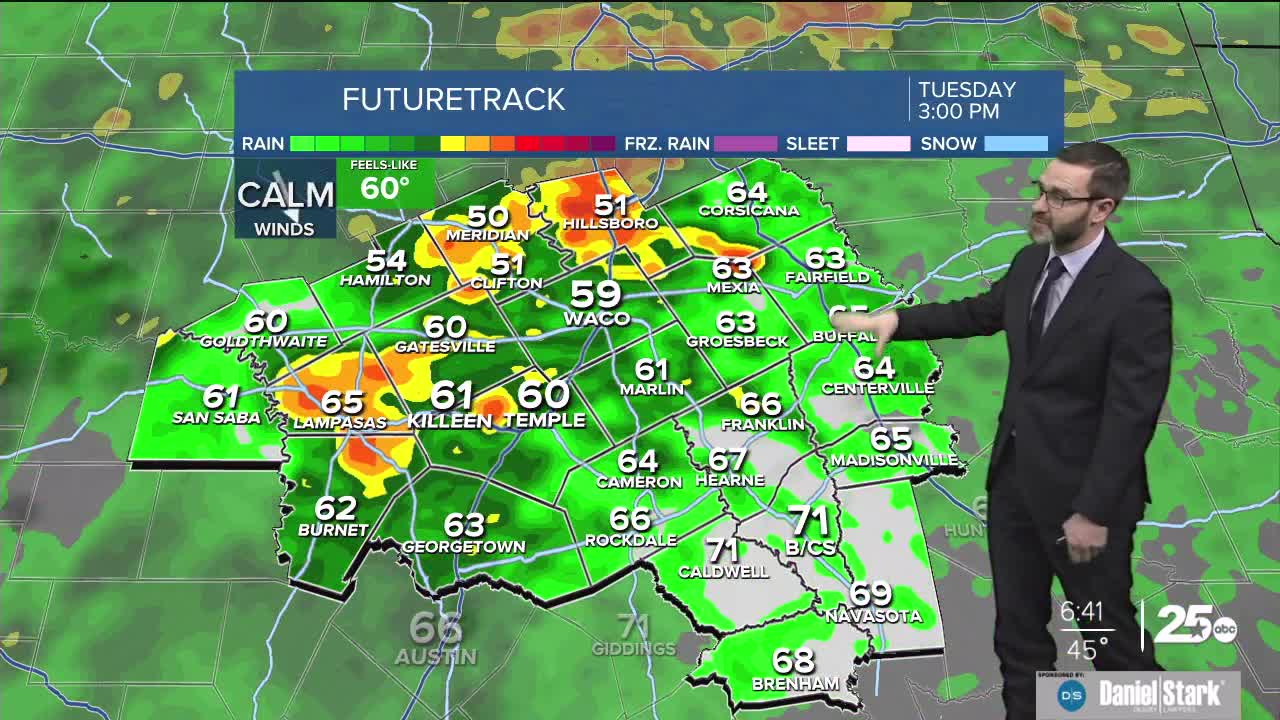


CENTRAL TEXAS — Rain chances will continue through the day today with highs staying in the 40s and the 50s. Rain chances continue through Friday.
THE BREAKDOWN:
- Rain chances continue this morning with heavy rain possible off and on today.
- Temperatures will stay in the 40s and the 50s today and tonight.
- More storm chances are on the way tomorrow, but we should see a break Thursday.
- Cold front moves in Friday bringing an end to the rain chances and ushering in a more temperate weekend for this time of year.
We're waking up this morning to fog and showers/storms across Central Texas. A dense fog advisory remains in effect through 10am, with areas of fog hanging around even where it's not raining.
Today will be a day you want to grab the umbrella, because rain chances look to hang around all day. I expect an increase in activity towards the middle of the day into the early afternoon. While no severe weather is expected, some storms could turn strong with heavy rain, gusty winds, lightning, and even small hail. A Flood Watch remains in effect east of I-35 due to the potential to see 2-4 inches of rainfall with locally higher amounts. Temperatures should hover in the 40s and 50s.
More rain chances are expected tomorrow with scattered showers and storms once again in the picture. Heavy rain may accompany the strongest storms once again. Temperatures will be in the 50s.
We may see a bit of a break from I-35 west on Thursday, though the Brazos Valley will still see high rain chances. If we can get some sunshine to break out, temperatures could climb into the 60s.
Another quick round of rain is possible Friday as our next cold front passes through. Behind it, much more temperate weather in the 50s will await us in the weekend.
Have a great day and stay dry!
Meteorologist Josh Johns
25 Weather
