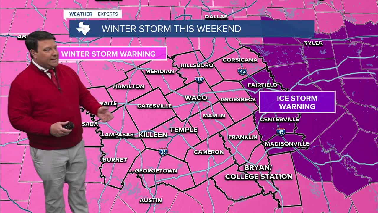


25 EVENING WEATHER — A winter storm will affect Central Texas and the Brazos Valley this weekend. The worst of the storms will arrive Saturday night into Sunday morning.
TONIGHT: Rain is likely across the area with falling temperatures. We should stay above freezing through sunrise Saturday, but we will see temperatures in the 30s with wind chills in the 20s by morning.
SATURDAY: Rain will transition to freezing rain and some sleet through the day Saturday. This will occur as freezing temperatures take over from north to south during the day. Areas from Waco/Temple/Killeen, north and west, will get to freezing during the morning hours Saturday. Areas closer to Bryan/College Station will get to freezing by mid to late afternoon. Watch out on bridges and overpasses and side streets for the potential of some icing during the day Saturday. Also, trees and power lines may start to accumulate some ice as well. Temperatures will fall slowly from the lower to mid 30s into the upper 20s and lower 30s by sunset.
SATURDAY NIGHT: This is when we expect the worst of the winter storm to hit the area. Temperatures will continue to fall through the 20s with wind chills in the single digits and teens. Areas of freezing rain and sleet will move over the area all night. Some of the precipitation could be heavy at times, and we may see a little lightning and hear some thunder as the main system gets close early Sunday morning. This is where we will likely see our most significant accumulations of freezing rain and sleet. Roads will ice over completely, so travel will become very hazardous. Trees and power lines will accumulate ice, so some power outages are possible.
SUNDAY: The winter storm will end of west to east Sunday morning, but the clouds will stick around all day. Highs will only be in the 20s, so what is on the ground will stay there and not melt. Travel will remain hazardous. That means we will likely have significant problems going into Monday morning with icy conditions.
Stay safe! We will continue to update you as new information becomes available.
Want this forecast delivered to your inbox each morning? Sign up for the daily forecast email newsletter here.
