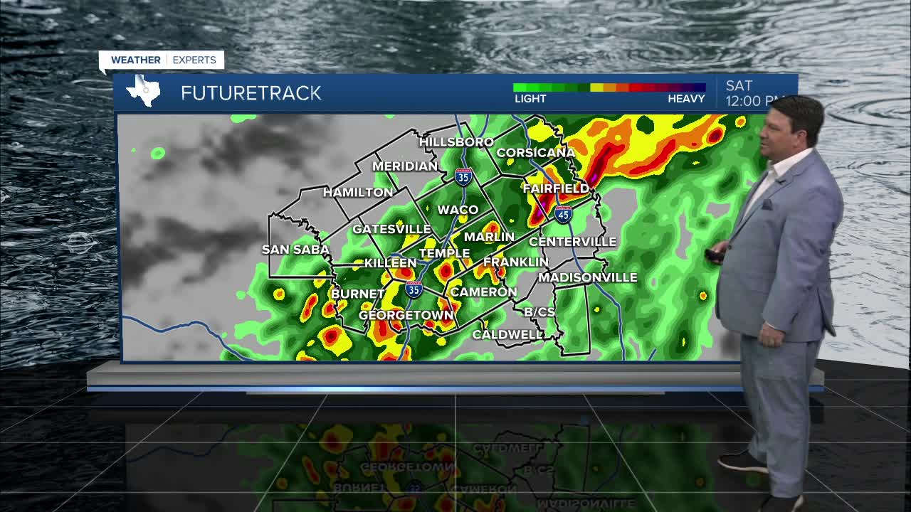


25 EVENING WEATHER — Easter weekend is here! A cold front is set to move into the area Saturday morning, and that will bring several changes to the area. Tonight, a few showers and storms will develop across west Texas. Some of these storms may try to move into areas west of I-35 late tonight into Saturday morning. I can't rule out a stronger storm with gusty winds and small hail, but the severe weather threat with this activity should be low. Temperatures in the morning will be in the upper 60s to near 70°. A cold front will slice into Central Texas Saturday morning. As the front moves south, it will bring showers and storms, breezy north winds, and falling temperatures. Once again, a couple of storms could be strong to marginally severe, but these should be few and far between. The main story is rain! We will likely see a half inch to an inch and a half across the region as this system moves south. There could be some locally higher totals as well. Temperatures will likely reach the low to mid 70s ahead of the front, but we should fall into the 50s and 60s behind the front. Be ready for that change Saturday afternoon. Rain will taper off from north to south Saturday evening with lows Easter morning in the upper 40s and low 50s. There will be another wave of showers move through our southern areas Easter Sunday. Most of the activity should be in south Texas, but there will be a 20-30% chance across our southern counties. Highs Easter will make it into the mid to upper 60s north and low to mid 60s south, where clouds will be thicker.
Next week is looking pretty nice Monday through Wednesday with highs in the 70s and lows in the 40s and 50s. Our next rain chances will arrive late next week on into next weekend. Right now it looks like it will be scattered, so we will keep an eye on this as we get closer.
Have a great Easter weekend!
Want this forecast delivered to your inbox each morning? Sign up for the daily forecast email newsletter here.
