

CENTRAL TEXAS — Central Texans will experience a cooler Thursday as a weak cold front makes its way through the area. Expect high temperatures in the low to mid 80s. Tomorrow will be similar with a mild morning and repeat afternoon.
This weekend calls for mostly sunny skies with a south wind helping to pull in warmer air. Expect highs in the mid 80s and dry skies. Sunday will be breezy with sustained winds reaching 20 mph.
The Brazos Valley will see slightly higher temperatures today. West of I-35 should feel less humid with lower dew points, compared to the Brazos Valley and east of I-35.
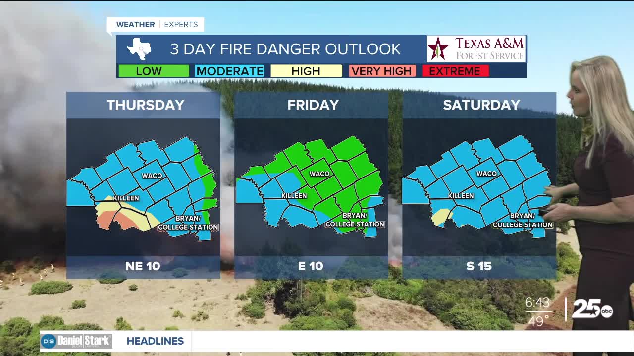
Burnet County is under a Red Flag Warning. Williamson and Burnet have a very high fire danger threat. The rest of Central Texas has fallen to a moderate risk. By Friday most of the area will be down to a low risk.
The next opportunity for rain comes mid week. The models are fluctuation but the set up of a low and high pressure system in the southwest will determine how much rain and when the precipitation will arrive.
Want this forecast delivered to your inbox each morning? Sign up for the daily forecast email newsletter here.
