

Cupid certainly got his arrows wet this Valentine's Day. The pacific cold front brought some much needed rain to Central Texas, however the area could certainly use more rain.
Some tree limbs were knocked down and winds gusts were felt up to 50 mph in today's storm. Thunderstorms passing through the Brazos Valley were more intense than what was experienced west of I-35.
The remaining precipitation will continue to move east. As the western half of Central Texas begins to dry out the eastern half will follow. There is potential for the northeast area of Central Texas, in and around the Corsicana area, to experience another quick shower overnight.
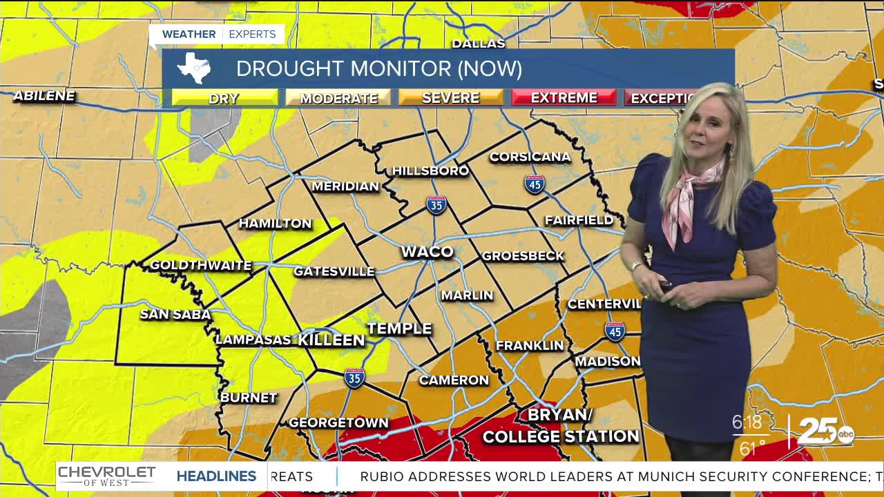
Rain totals were variable. Some landed between a few tenths of an inch to about two inches in select areas. West of I-35 received less than an inch, and the Brazos Valley experienced the most accumulation. Some areas near Hillsboro also saw over an inch of rainfall. The extra rain is appreciated as the drought conditions in the Brazos Valley are currently some of the most intense in Central Texas.
By sunrise, all the rain should have exited the area.
It will be a cool morning but certainly not as cold as the back end of several previous fronts. Expect wake-up temperatures in the 50s.
It will be partly cloudy on Sunday with highs just under 70 degrees. It will be breezy with north winds up to 15 mph and gusts up to 25 mph, therefore a jacket is recommended. The wind chill will make it feel slightly cooler.
Monday is the birthday of President Washington and many government agencies have the day off. The holiday wake-up call will be chilly with temperatures in the 40s. However, it's recommended to layer your clothing because high temperatures will reach the low 70s and sunshine will prevail on Monday.
There are no rain chances until we begin to head into next weekend. Moisture returns to the atmosphere but it appears if we do get some wet weather, at this point it will be very little.
