

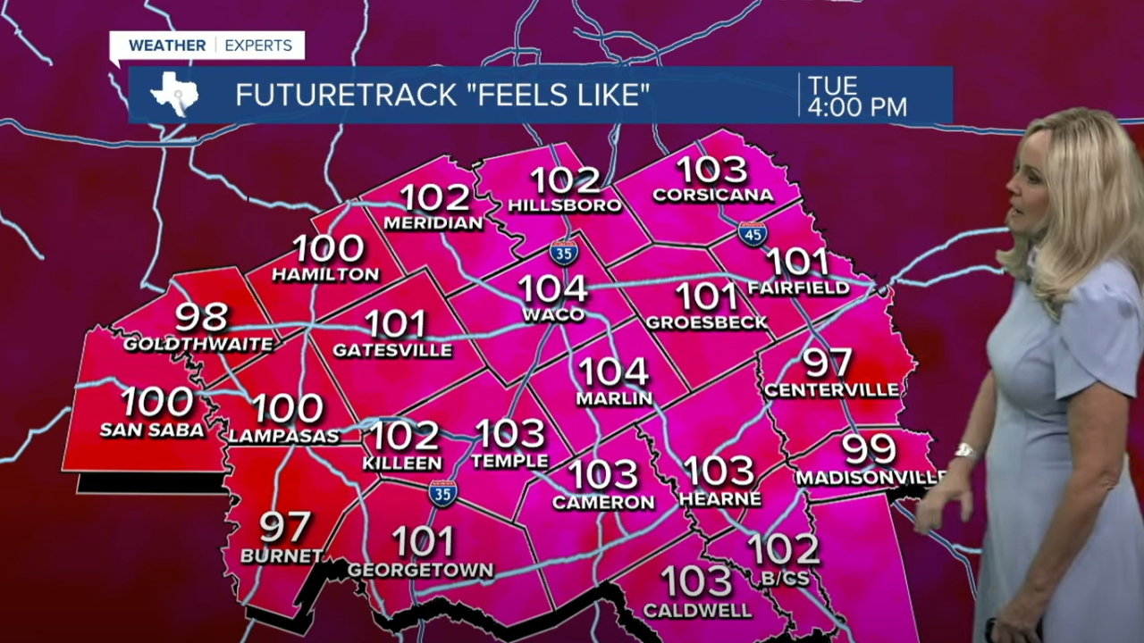


CENTRAL TEXAS — The second week of August is filed with triple digit temperatures, breezy conditions and dry vegetation. Air temperatures are expected to reach 100 degrees all week, with heat indices near or at 105 degrees. These conditions will be very close to the heat advisory criteria, so residents should treat the week with caution. Hydration and sun protection are recommended as ultra violet rays will once again reach the very high category between noon and 3 p.m.
The hot conditions and dry vegetation are a concern this week as the breeze picks up. Winds have increased to 10 to 20 mph with gusts above 25 mph expected late in the week. Bell County will join the burn ban this evening. Robertson and Falls county were added yesterday. They join McLennan, Hill, Limestone, Freestone, Navarro, Madison, San Saba, Mills and Burnet.
Most of Central Texas is under a moderate threat for fire danger, with Coryell landing in the high category. By Thursday most of Central Texas will move into the high category.
In the tropics, three disturbances have a chance of developing into a tropical system. One off the coast of Africa has a 70% chance of development. At this point it's track would head east then turn north, moving further into the Atlantic Ocean. The other tracks have a 10% chance of development. We will continue to monitor these disturbances as the peak of hurricane season gets closer.
Want this forecast delivered to your inbox each morning? Sign up for the daily forecast email newsletter here.
