



CENTRAL TEXAS — Central Texans are kicking off another week in August with air temperatures expected to run just above average. We should hang out around 100 degrees all week.
Hot temperatures remain but the heat index is the bigger story. As dew points climb from the mid 60s to the 70s, the heat index will climb with it. Expect feels-like temperatures to be at or above 105 degrees later this week. Since that is the threshold of when the National Weather Service issues a heat advisory, we could see some issued by Wednesday.
The best chance of rain will likely be this afternoon and it is very low. Some models are picking up on a stray isolated shower but that opportunity is less than 20% of the area. We are mainly looking at high pressure dominating Central Texas, trapping in that heat, and keeping our area dry and mostly sunny as the week progresses.
On a somewhat positive note, this week the winds will pick up starting Tuesday. A tighter pressure gradient arrives which will bring our southerly winds between 15 and 20 mph with gusts up to 25 mph through Friday. Thursday and Friday will likely be our windiest days.
The breeze will provide a little relief from the heat but on the flip side, it will increase the fire danger from moderate to high in some areas of Central Texas. A burn ban remains in effect for McLennan, Hill, Navarro, Freestone, Limestone, Madison, San Saba, Mills and Burnet counties.
The Brazos Valley will see slightly cooler air temperatures with highs in the upper 90s. But don't get too excited. Humidity from the sea breeze will kick up the heat index into the triple digits, similar to Central Texas.
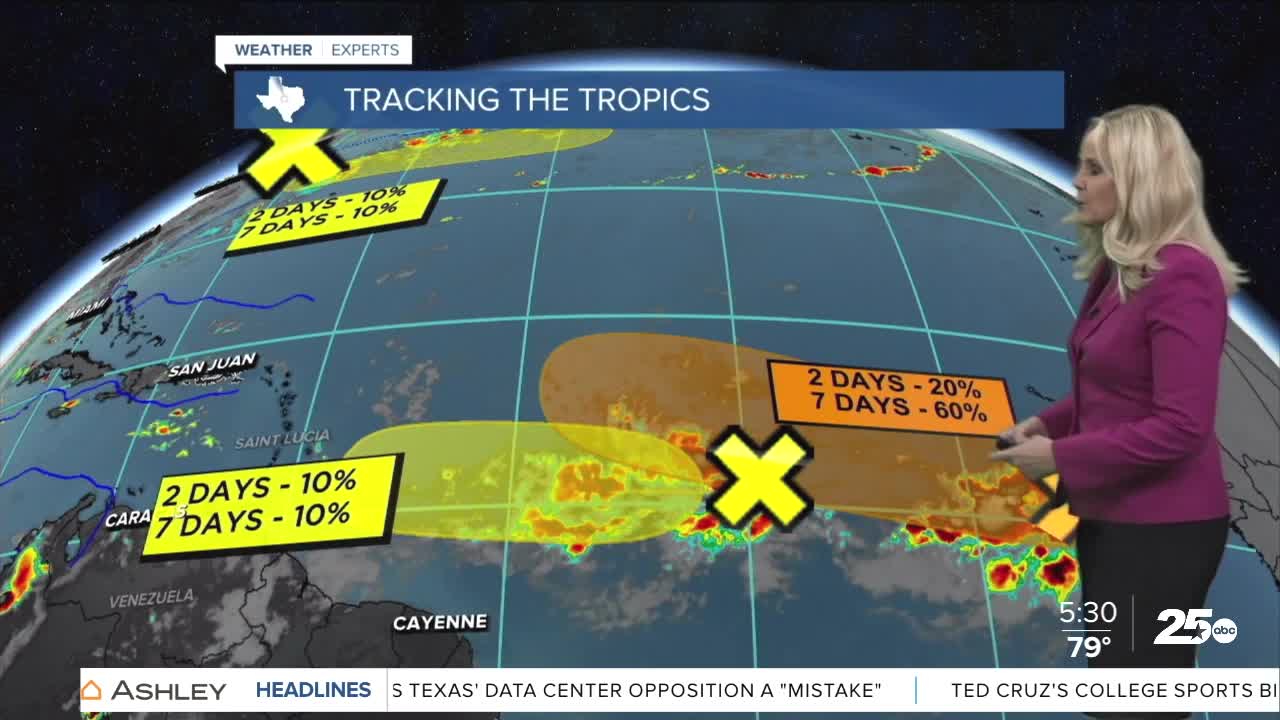
Meanwhile, we are getting closer to the peak of hurricane season as we continue to track the tropics. There are three disturbances in the Atlantic Ocean. One near the northeast coast of the United States has a ten percent chance of developing in the next two and seven days. It's track would head east, away from the U.S. The other two disturbances are off the coast of Africa. One with a ten percent chance of developing in two and seven days. The second has a 20 percent chance in two days and a 60 percent chance in seven days of turning into a tropical system. We will continue to monitor these storms.
Want this forecast delivered to your inbox each morning? Sign up for the daily forecast email newsletter here.
