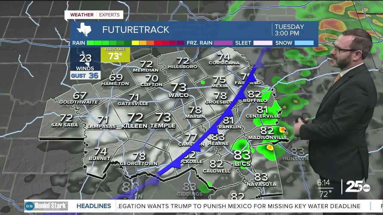


CENTRAL TEXAS — Highs will climb into the upper 70s by midday when a cold front works in. Winds could gust as high as 35mph this afternoon with temperatures in the 40s by morning.
THE BREAKDOWN:
- Strong cold front arrives around midday.
- Wind gusts to 35-40mph possible behind it.
- Temperatures fall to the 40s by morning.
- Fall-like conditions into Halloween.
Good morning! Today's the day our first strong cold front arrives! Expect warm and muggy conditions in the 70s until it arrives around midday. Behind it, we'll see gusty winds from the northwest take over. They'll be sustained around 25mph, but could gust as high as 35-40mph. Because of that, a wind advisory has been issued for our area through Wednesday afternoon. Many of you have halloween inflatables out, you will need to secure them or bring them inside as they could end up down the street! While this will pass on a dry note for most, a few isolated showers and storms will be possible east of I-35.
Chilly air will work in through the evening, dropping us to the upper 40s and low 50s by morning. Of course, with the wind, it will feel cooler. You need to pull down that jacket that's been in storage if you haven't already. Daytime temperatures will only make it into the mid 60s Wednesday with winds continuing to gust to near 40 mph. It should be a jacket day. The coldest air will settle in Thursday and Friday morning as we drop into the low 40s with upper 30s in spots.
Halloween looks great with quiet weather and highs in the 70s! That will put trick-or-treating temps in the 60s!
Models have hinted at another system coming in on Saturday. I've increased rain chances a bit, but still not expecting a washout. A few showers and storms will be possible with a weak little front that moves thorugh. That will keep us in the 60s with 70s for the start of the new week!
Have a great Tuesday!
Meteorologist Josh Johns
25 Weather
