


CENTRAL TEXAS — A powerful storm system sitting over the Central Plains will be responsible for Central Texas' severe thunderstorm chances on Tuesday. Until then, a dry line over west Texas could create a limit number of thunderstorms west of I-35 tonight and Monday night.
The dry line is currently near San Angelo, and humidity is much higher today across central Texas with dew points in the 70s. As of 5pm, a few spotty showers are trying to from near San Saba and this will be monitored for any thunderstorm potential. However, models have consistently failed to simulation any intense thunderstorm action for Central Texas and my forecast is mostly in line with that. I'll "monitor" just in case, but high humidity alone isn't enough to create powerful thunderstorms.
Monday's thunderstorm chance is in that same vein. High humidity and a dry line encroaching on Central Texas. But models mostly have nothing to offer up. I will go a 20% chance for storms because the low pressure center that's controlling the weather pattern across the plains will be fully matured on Monday and at it's peak strength. Even Kansas is up to a Moderate Risk for severe weather according to the Storm Prediction Center.
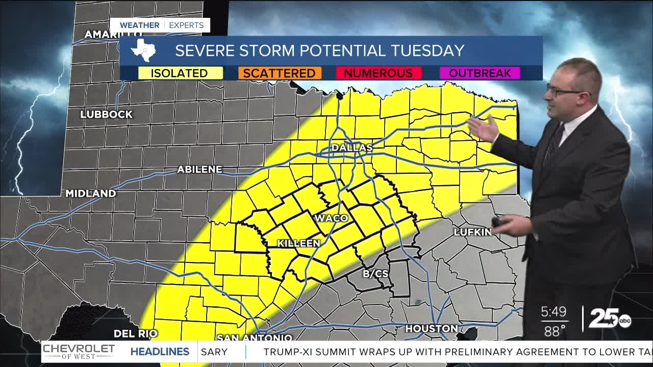
To Tuesday... the cold front with this storm system will finally push through Texas with a line of thunderstorms along it. That plus outflow winds could get most of Northern and Central Texas a quick chance for isolated severe thunderstorms at some point in the afternoon or evening, between 2pm and 10pm. The storms will fade and be sub-severe before arriving in the Brazos Valley and Houston regions. Meanwhile, a cluster of thunderstorms is likely to spawn in Northern Mexico and move eastwards towards San Antonio at the same time. This will probably stay south of us, but could interact with the cold front that's pushing through.
For Wednesday to Friday, broad rain and thunderstorm chances will hang around Central Texas. However it's hard to impossible to stay exactly what will happen or how intense these storms could be since each day's weather will depend on the day-before's thunderstorms. In total, Central Texas will get about 2-5" of rain over four days. Minor flooding and road ponding is possible, yet this rain should be healthy and drought busting, especially if it falls in areas east of I-35.
- 25 News Meteorologist Thomas Patrick
Want this forecast delivered to your inbox each morning? Sign up for the daily forecast email newsletter here.
