

CENTRAL TEXAS — Wednesday kicks-off a much warmer pattern for Central Texas as southerly flow strengthens and high pressure in the southwest shifts farther to the east. Winds have significantly lessened compared to the start of the week, but a light breeze from the south will develop this afternoon.
Highs will climb into the upper 70s making for a gorgeous, mostly sunny and very dry afternoon. As we move into the week, we will continue to see temperatures climb. There could be record highs this weekend as temperatures reach the 90s.
However, the moisture isn't returning as fast as the warmth, so if you're west of I-35, fire weather will be high concern again this afternoon with humidity dropping into the 20s and 30s. East of I-35 remains at the moderate threat level.
If you have any outdoor burning plans, today is not the day. Tonight will be a much milder night compared to recent days, with lows settling into the low 50s under continued southerly flow.
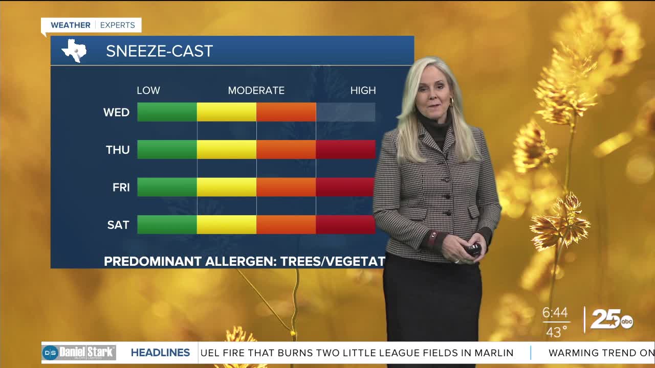
Pollen levels have spiked and will reach high levels Wednesday afternoon. Over the next few days the levels will continue to climb. So those with allergies should prepare accordingly.
This story was reported on-air by a meteorologist and has been converted to this platform with the assistance of AI.
Want this forecast delivered to your inbox each morning? Sign up for the daily forecast email newsletter here.
