

CENTRAL TEXAS — Strong thunderstorms started to fire up west of I-35 after 2pm Sunday afternoon after several rounds of morning rain and thunderstorms. These thunderstorms will continue to pepper regions along and west of I-35 for the remainder of the evening. Individual storms are traveling North-Northeastward at a slow pace. Severe weather isn't out of the question, but risks will mainly be small hail, wind gusts around 40mph, frequent lightning, and heavy rain. Rain totals could climb to 3" for some affected.
A Severe Thunderstorm Watch is unlikely to be issued today.
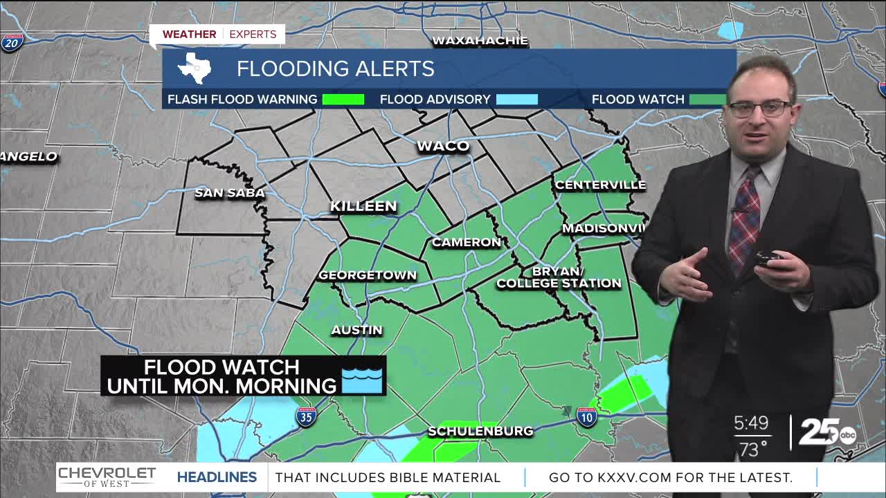
A Flood Watch was issued for Bell, Williamson, Milam, Robertson, Leon, Burleson, Brazos, Madison, and Grimes counties until 4am Monday morning. A complex of thunderstorms closer to I-10 have prompted Flash Flood Warnings for excessive rain, but this has so far stays south of the Brazos Valley.
Any thunderstorms, severe or not, should conclude by 10pm tonight. After which, conditions remain humid with lows in the upper 60s. Monday's storm chances have diminished greatly, and only an isolated chance for showers and storms remain for those east of I-35. Waco is looking dry. Highs climb to the low to mid 80s.
The next thunderstorm chance appears to be around Wednesday of this week. There is a chance for stronger storms but Waco is at the extreme southern most extent of thunderstorm chances to begin with, so this isn't a particularly great chance for nasty thunderstorms. The bulk of that action is likely well north extending from Dallas, TX to Milwaukee, WI.
The week finishes very warm. Waco's high temp will climb to about 86 degrees and College Station up to 88 potentially.
- 25 News Meteorologist Thomas Patrick
Want this forecast delivered to your inbox each morning? Sign up for the daily forecast email newsletter here.
