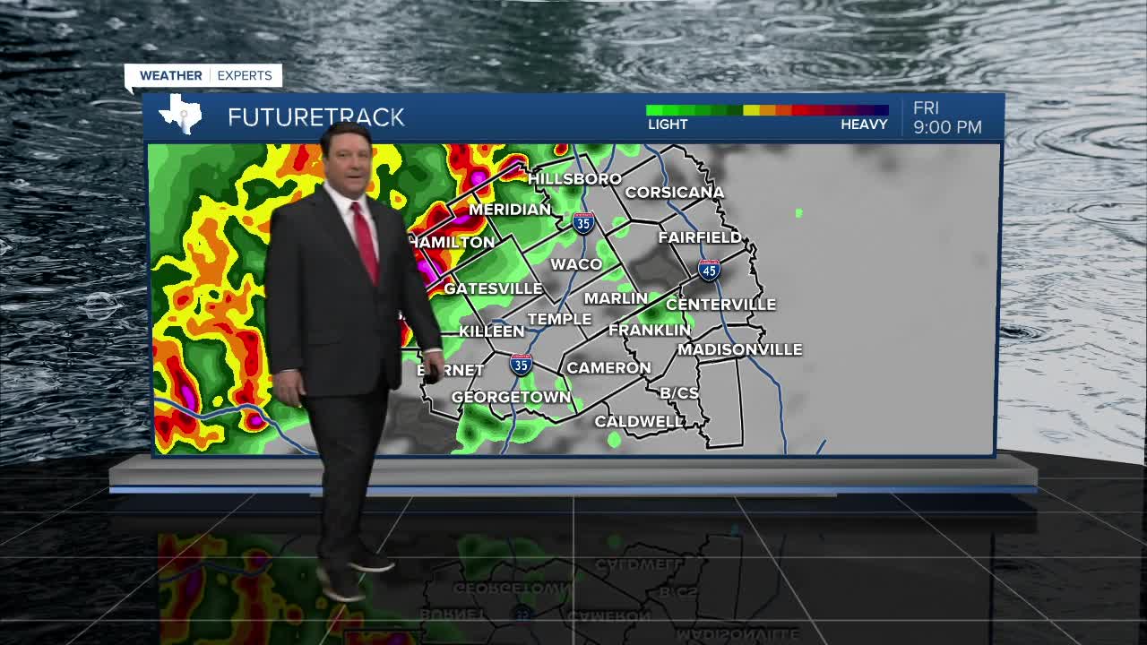


25 EVENING WEATHER — It will be a stormy night across Central Texas. Thunderstorms will start to develop this evening and become more widespread as we head through the overnight hours. A few storms could be severe with pocket change size hail and winds up to 65mph in the strongest storms. There could be a low end tornado threat west of I-35 this evening as well. Storms will start to slowly weaken east of I-35, but some strong wind gusts will be possible through early Saturday morning. There is also the potential for heavy rain. 1-2 inches looks likely, but some isolated areas may see 3-4 inches of rain. That is why a Flood Watch is in effect through Saturday morning across a good portion of Central Texas.
Saturday should bring a break in the activity during the morning hours. Another piece of energy will swing into the area Saturday afternoon, and this may initiate more scattered thunderstorms. The severe threat looks a bit lower, but we could see a few storms produce some large hail, especially south and east of Waco. Highs Saturday look cooler with highs in the mid 70s.
Sunday should be the banner day of the weekend. We will have more sunshine and highs will warm back into the low 80s.
Another warm day is expected Monday ahead of a strong cold front. Highs will be in the mid to upper 80s, but it won't last. Our cold front will sweep across the area Tuesday, allowing temperatures to fall into the 70s for highs for the rest of the week. In fact, some folks may stay in the upper 60s Wednesday afternoon! Lows at night are expected to be in the 40s. Hello Fall!
