


CENTRAL TEXAS — We're tracking strong thunderstorms in North and Central Texas into the evening. These storms have a low-end severe weather chance (high winds and large hail) but a greater risk for more flash flooding due to the extremely heavy rain potential.
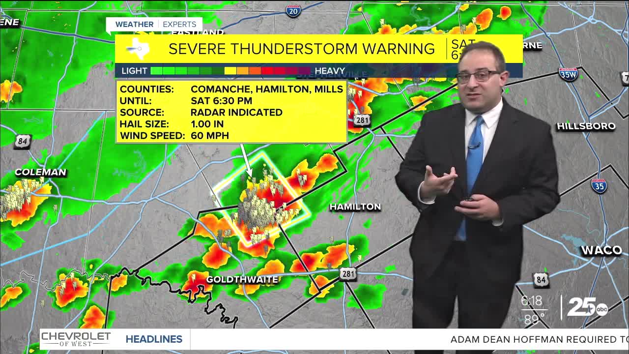
Flood Watches are in effect for all of Northern Texas through Sunday afternoon and we just added to Mills, Hamilton, Bosque, and Hill Counties and goes through 4pm Sunday. Stronger storms that have been in this region already this even may continue to see more heavy rain and be at risk for Flash Flooding tonight. Locations closer to Waco and Gatesville may be at the southern most tip of these storms, so we'll wait-and-see to see how much more rain may fall tonight.
The heaviest rain yesterday and early this morning fall over Falls and Bell Counties, where Doppler Radar estimates as much as 10" of rain fell! Ongoing flooding and high water levels are stilla concern, especially for the Little River, Salado Creek, and Boggy Creek.
One more chance for pop-up thunderstorms Sunday, but latest weather model trends keep a limited amount of activity nearest the I-45 corridor and Brazos Valley.
Next week, the weather pattern should be significantly calmer and hotter. Temperatures will be above average and in the low- to mid- 90s for Central Texas. I forecasted as hot as 95 by the end of the week for Waco. Unfortunately, the humidity is still sky high with dew points between 70-75 degrees most days. That means the feels like, or the Heat Index, will be near 100 degrees most days. Additionally, the humidity could still spark a stray storm or two, but indications are that will be very few and far between. A few days upcoming may have a 20% chance for rain (which is our threshold to put the thunderstorm icon on the 10-day forecast), but nothing greater than that for now.
- 25 News Meteorologist Thomas Patrick
Want this forecast delivered to your inbox each morning? Sign up for the daily forecast email newsletter here.
