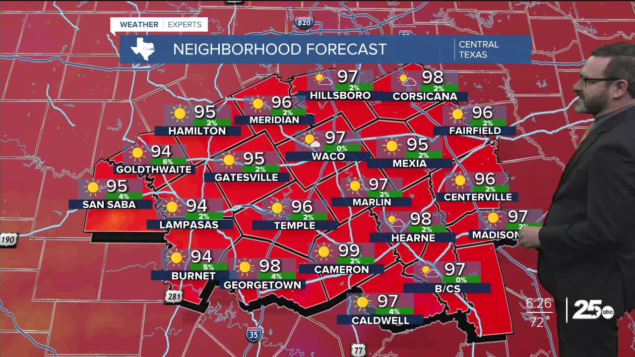


CENTRAL TEXAS — Highs will climb into the upper 90s this afternoon, with feel-like numbers approaching 100. Showers and storm chances return for the second half of the week.
THE BREAKDOWN:
- Typical August heat to start the work week.
- Pattern change in the jet stream for the second half of the week.
- Rain chances, and a cold front possible.
Good morning! We're waking up to a quiet morning across Central Texas with temperatures in the 70s to start the day. Expect typical August heat to settle in as highs climb into the mid to upper 90s this afternoon. With typical humidity, that will make it feel closer to 100 later this afternoon. Some high clouds will be around, but overall, things look quiet.
High pressure will start to slide south here for the middle of the week with the potential for a cold front to get closer to us. Right now, I have that taking us down into the low to mid 90s for the middle of the week. As the pattern starts to shift from the movement of that high, we will see a dip in the jet stream pull in for the weekend. This will likely send a cold front our way, though the timing is debatable right now. I do think that will bring rain chances up for the weekend with showers and storms possible. For now, I've only taken highs into the upper 80s and lower 90s for the weekend, but if the cold air is stronger, we may have to lower them further. Stay tuned!
Have a great Monday!
Meteorologist Josh Johns
25 Weather
