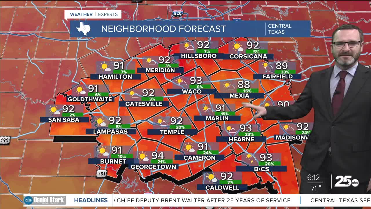


CENTRAL TEXAS — Highs will climb into the low 90s this afternoon under partly cloudy skies. An isolated shower or two will be possible across the Brazos Valley.
THE BREAKDOWN:
- Small chance of an isolated shower in the Brazos Valley today.
- High pressure keeps temperatures warm this week.
- Small pattern change may lead to rain chances this weekend.
Good morning! We're waking up to a little bit more in cloud cover and humidity with lows in the upper 60s and low 70s. While the majority of us stay quiet, there may be enough energy and moisture to bring a stray afternoon shower to areas east of I-35 and into the Brazos Valley. The majority of us will miss out.
Expect warm and relatively muggy conditions to continue this week with high pressure in place. We'll see morning lows near 70 and afternoon highs in the low to mid 90s. There are signs high pressure will weaken later this weekend as a dip in the jet stream comes in. This will send a cold front south, though I think it will stop short of Central Texas. This may provide enough lift for isolated to scattered showers and storms Saturday through Monday, with the best chances across the northern half of Central Texas. The extra clouds and moisture should keep temperatures close to 90. Some models bring that front closer, but I'm not buying it yet. Stay tuned!
Have a great Monday!
Meteorologist Josh Johns
25 Weather
