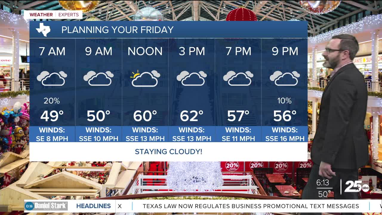


CENTRAL TEXAS — Expect cloudy conditions to hang around through the day today keeping highs in the 50s and the 60s. Storms will be possible tomorrow ahead of a strong cold front.
THE BREAKDOWN:
- Cloudy and cool conditions hang around today.
- Light showers possible this evening.
- Showers and storms possible tomorrow.
- Strong cold front arrives tomorrow evening.
Good morning! Hopefully you're all stuffed with turkey, because you'll need it for the warmth as we will only climb into the upper 50s and lower 60s this afternoon. Clouds will be quite stubborn, and actually should increase through the day. Eventually, these clouds may get enough moisture to start some light showers later tonight.
Warm air works in by morning with afternoon highs Saturday reaching the mid to upper 70s ahead of a strong cold front. That should provide enough lift for showers, and even some storms Saturday. While most of these storms will behave, the highest chances will be east of I-35, and that's where a couple could turn rowdy with the potential for some hail. Showers and storms will clear as the strong cold front works in during the evening bringing 30s by morning. Feel-like numbers will be near freezing Sunday morning and highs will only reach the 40s!
Chilly air hangs around through Tuesday with another chance of rain, once again favoring areas east of I-35, possible on Monday. Temperatures slowly warm up before another cold front Thursday that won't be as strong.
Have a great Friday!
Meteorologist Josh Johns
25 Weather
