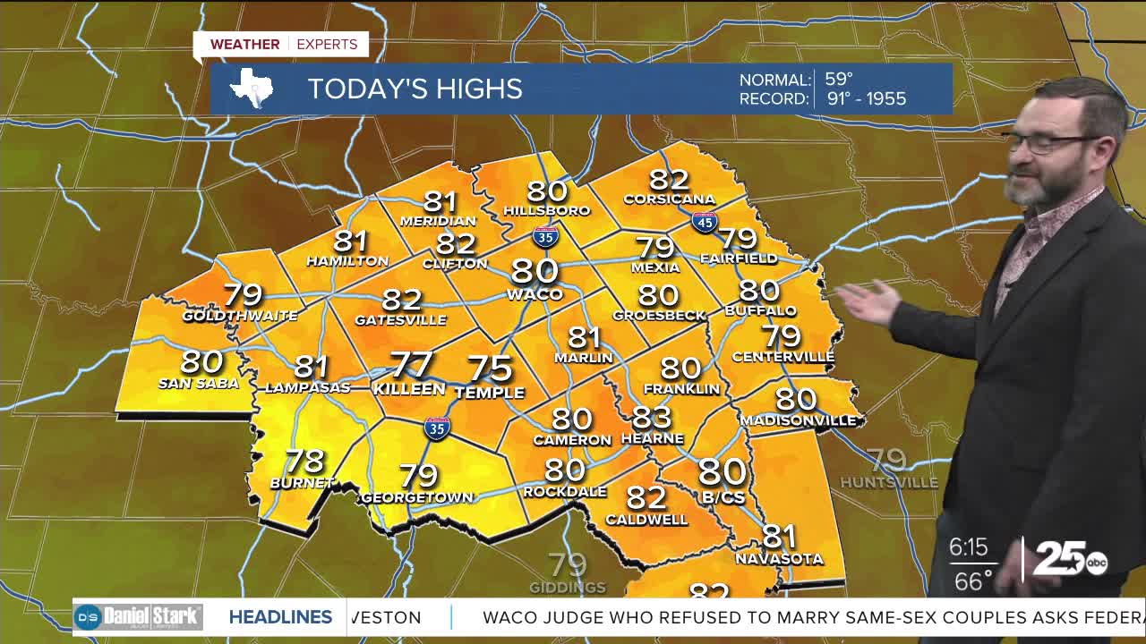


CENTRAL TEXAS — Unseasonably warm weather will continue to hang around today after record-breaking heat yesterday. We'll once again target numbers near 80 this afternoon, but records will stay in tact. That's only because our record high today is in the 90s and was the highest December temperature ever recorded in Central Texas. South breezes will help us get there at 15-20mph.
Overnight, we won't see a big cool-down either, as lows will fall into the mid 60s. Clouds will thicken up and even some patchy fog can't be ruled out that Rudolph will need to guide Santa through. Christmas will be warm again as temperatures climb into the low 80s. We'll crank it up a notch Friday as the heat crests around the mid 80s. More records will likely fall.
The weekend will bring changes with highs in the 80s Saturday before a cold front arrives Sunday. Models have slowed down this front a bit, so we may still see mid 70s before it arrives in the afternoon. A few showers or an isolated storm could be possible along the front but rain amounts will be very light. Behind the front, highs could struggle to get out of the 40s Monday which will bring the December chill back!
Have a Merry Christmas eve!
Meteorologist Josh Johns
25 Weather
Want this forecast delivered to your inbox each morning? Sign up for the daily forecast email newsletter here.
