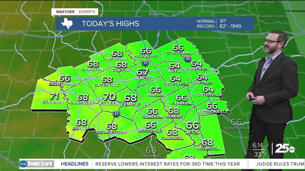


CENTRAL TEXAS — Thursday will start off with numbers near freezing, but south winds will push temperatures into the upper 60s. A warm up will take us through the end of the week with highs nearing th
THE BREAKDOWN:
- Cold this morning with lows in the low 30s.
- South winds bring back 60s in the afternoon.
- Staying warm to end the week.
- Next cold front arrives Sunday.
Good morning! We're waking up to quiet and cold conditions with numbers hanging around in the low 30s. Winds are slowly shifting and will shift to the south today bringing back warmer air for the afternoon. Highs will likely climb into the upper 60s. South winds will continue overnight, leading to a slightly warmer morning as we start off in the mid 40s. As south winds continue, we'll see highs closer to the 70s Friday afternoon.
As moisture increases, Saturday is looking increasingly cloudy. With the clouds, its more likely we can only climb into the mid 60s. This will be ahead of our next front which brings colder air for Sunday. Sunday will likely see highs only in the 50s. As a disturbance dips south into the Lone Star State Monday into Tuesday, we could see a few showers. Right now, the moisture looks to be lacking for any meaningful rainfall, but there should be enough lift to create at least a few showers. Stay tuned!
Have a great Thursday!
Meteorologist Josh Johns
25 Weather
Want this forecast delivered to your inbox each morning? Sign up for the daily forecast email newsletter here.
