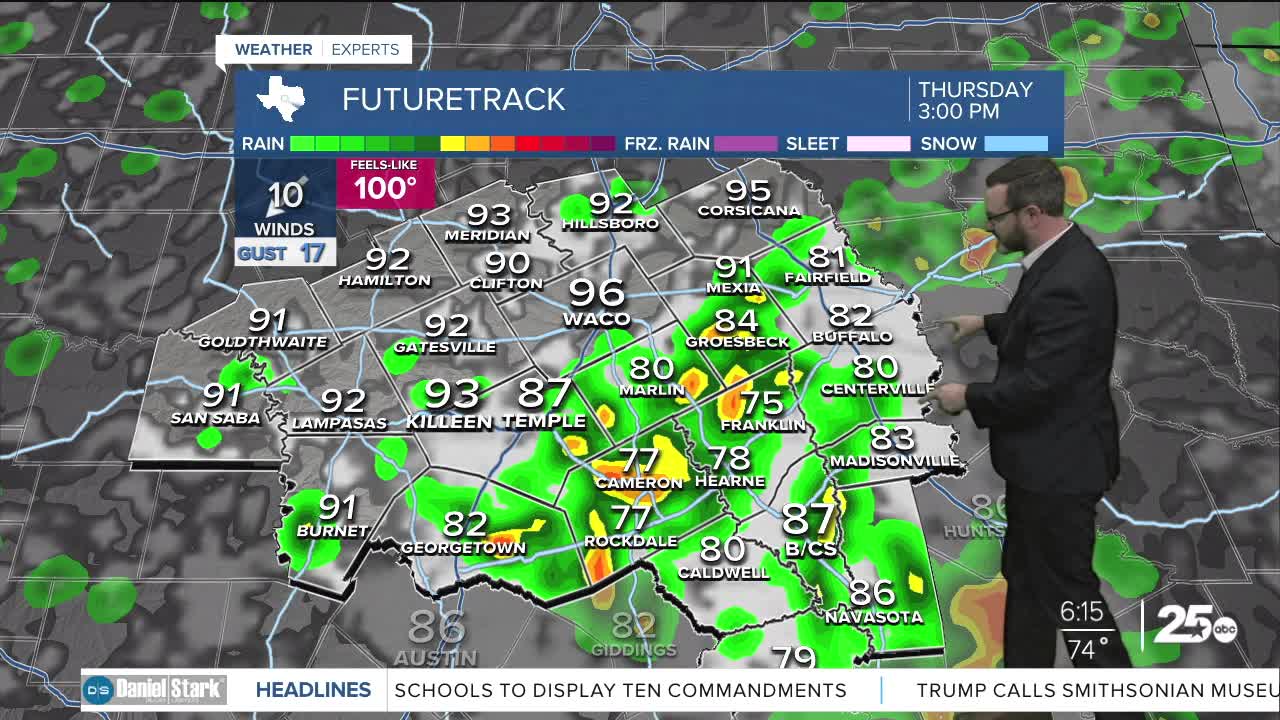


CENTRAL TEXAS — Highs will climb into the mid 90s with some showers and storms possible this afternoon. Expect less rain chances and more heat for the weekend.
THE BREAKDOWN:
- More showers and storms possible this afternoon.
- Low severe weather threat.
- Drying for the weekend.
- Another cold front possible next week.
Tyler Dupnick caught rain Thursday morning on his drive through Robertson County:
Good morning! We're waking up to temperatures in the mid 70s and relatively quiet weather across Central Texas. A few downpours have been able to fire up in the Brazos Valley, and a few may be possible this morning, but better rain chances will hold off until the afternoon. As temperatures climb into the mid 90s (feeling closer to 100), we will see leftover boundaries from yesterday's storms fire new storms. The coverage should be generally lower, but some storms could once again produce heavy rain and gusty winds. Expect activity to lessen into the evening.
Some isolated storms will still be possible Friday, but chances will lessen into the weekend as highs climb back into the upper 90s. There are signs a stronger front will come in towards Tuesday/Wednesday of next week bringing temperatures back down into the low 90s and rain chances for next week. Stay tuned!
Have a great Thursday!
Meteorologist Josh Johns
25 Weather
