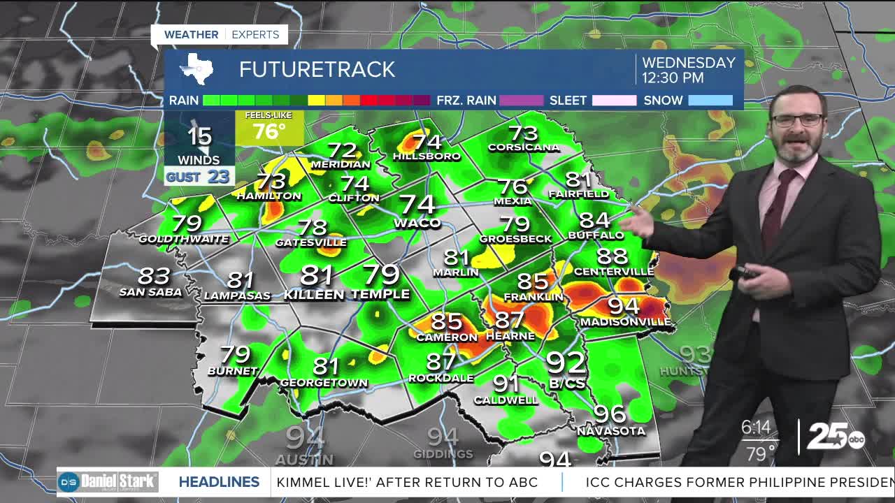


CENTRAL TEXAS — Highs will reach the upper 70s and lower 80s this afternoon as a cold front helps to fire showers and thunderstorms across the area. Expect quieter weather for the second half of the week.
THE BREAKDOWN:
- Highs will climb into the upper 70s and lower 80s this afternoon as a cold front works in.
- Expect scattered showers and storms, favoring the first half of the day.
- Quieter and more fall-like for the rest of the week.
Good morning! Today's the day our cold front arrives in Central Texas and it will make it's presence known! While we won't see much in the way of cooler air, there will be a pretty decent chance of showers and storms, particularly during the first half of the day. Some of these may be strong with gusty winds and small hail. With our front hanging around, there will be spots where this rain localizes. If that happens, we could see some rain totals towards 2 inches. The good news is it looks like most of this will hit when you're at work, but if you have a later morning commute, you may run into some of these storms. Activity will taper later on this afternoon. The longer clouds hang around, the cooler we will be, with many areas struggling to make it out of the 70s.
Cooler and drier air is set to work in as we round out the week. Morning lows will likely be in the low 60s Friday and Saturday morning. It'll still be warm in the afternoon with highs in the upper 80s and low 90s into the weekend. The nice part is the dry air will keep it much more comfortable!
Have a great Wednesday!
Meteorologist Josh Johns
25 Weather
