

25 EVENING WEATHER — It will become mostly cloudy tonight with some patchy drizzle. Lows will be in the upper 60s. Friday, there will likely be some scattered showers and isolated storms throughout the day. However, a cap of warmer air a few thousand feet up may prevent may severe storms from forming. If a storm can break the cap, then large hail and strong winds would be likely. The chance of that happening in our area is low. It will be warm and muggy Friday with highs in the low 80s.
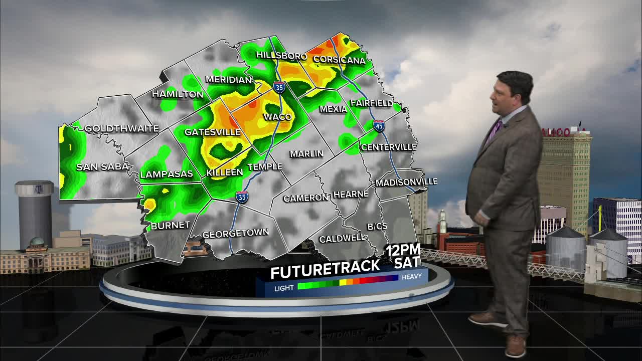
A cold front will race into Central Texas Saturday. This will set the stage for thunderstorm development Saturday morning. A few of these storms may produce large hail and gusty winds. A line of storms should mature along the front by lunchtime into the afternoon hours. These will mainly affect the Brazos Valley. Strong winds and some hail will be possible. Once the front passes, temperatures will fall from the 70s into the 50s and 60s, especially across Central Texas Saturday afternoon. This will limit the severe weather threat, and we will shift to more of a heavy rain threat. On and off scattered showers and storms are expected Saturday night into Sunday morning. Rain chances should taper off through the day Sunday with highs in the mid 60s. Storm totals of 1-2 inches is likely this weekend.
Want this forecast delivered to your inbox each morning? Sign up for the daily forecast email newsletter here.
