

UPDATE:
The National Weather Service has issued a Tornado Warning for Northwestern Hill County until 8:00 p.m.
ORIGINAL:
An active weather pattern is expected through the end of the week. A cold front will push south out of north Texas into Central Texas tonight. A few storms are possible along the front, especially from Waco, north and east. A couple of storms could be severe this evening with large hail, strong winds, and possibly an isolated tornado.
The severe threat should diminish after midnight. Lows will fall into the mid 60s.
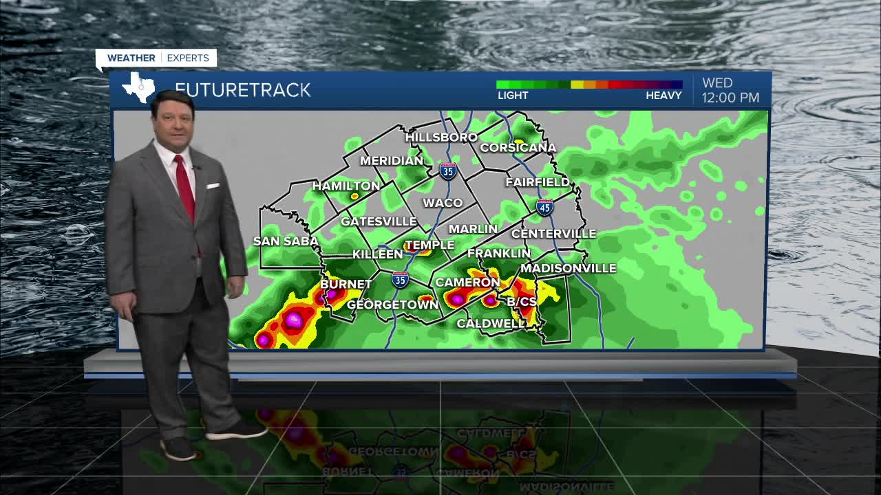
Wednesday will bring a chance of scattered showers and storms, especially across the southern half of the area as a cold front continues to push south through the day. It will be cooler with highs in the low 70s north and near 80° south. A couple of storms could be strong with some hail potential Wednesday morning into early afternoon.
A stronger system will bring a chance of widespread heavy rain late Thursday into Friday. The cold front will likely remain south of the area, and there will be a reinforcing front coming through the area Friday. Right now, it looks like any severe weather threat will be low, but we could see pockets of heavy rain. 1-3 inches of rain are possible, but locally higher totals could occur. Highs Thursday will be in the upper 60s, but we could stay in the upper 50s and low 60s Friday with all the clouds and rain around.
The weekend is looking much drier as the system pushes east. It will be mostly sunny to partly cloudy Saturday and Sunday. Highs are expected to be in the upper 60s Saturday and mid 70s Sunday.
Want this forecast delivered to your inbox each morning? Sign up for the daily forecast email newsletter here.
