

25 EVENING WEATHER — Our next storm system will be on approach tonight, but we should be quiet with the exception of a few isolated showers. Lows will fall into the upper 60s to near 70°.
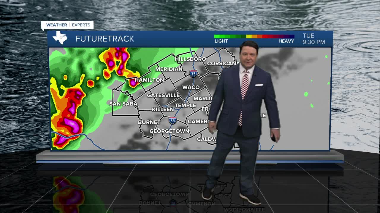
Tuesday, a cap will be in place over Central Texas for much of the day. A couple of storms may try to get going in afternoon, but they should be isolated. If a storm can get going, large hail and strong winds would be possible. Better storm chances should arrive from the west Tuesday evening. The highest potential of severe weather will be west of highway 281, back toward Goldthwaite and San Saba. This is where we may see a couple of storms produce large hail, strong winds, and an isolated tornado. As storms move east Tuesday night, instability values will be lacking for severe weather, so we should see significant weakening as storms move to I-35 and points to the east. We will continue with some rain and storms chances Wednesday morning across the eastern half of the area. There is also some potential for rain Wednesday afternoon if any wrap around moisture can be squeezed out. Highs Wednesday will be in the mid 70s with winds shifting to the northwest at 10-20mph.
It looks cooler Wednesday behind a cold front with highs in the mid to upper 60s under sunny skies. It will stay mostly sunny with highs in the mid to upper 70s Friday.
The weekend is looking warm with highs in the low 80s Saturday and Sunday. A strong cold front should arrive late Sunday. This will send highs back into the 60s early next week with lows in the 30s and 40s.
Want this forecast delivered to your inbox each morning? Sign up for the daily forecast email newsletter here.
