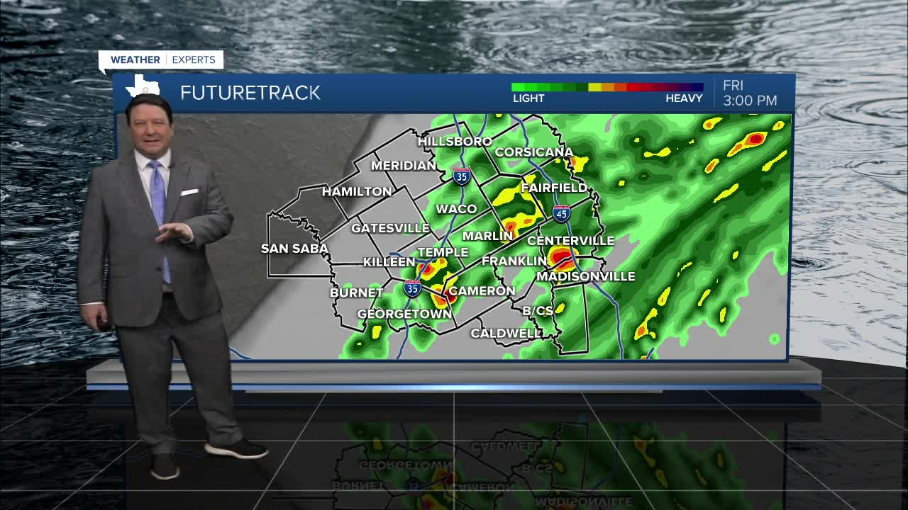


25 EVENING WEATHER — Our next disturbance is on the way to Central Texas Friday. For tonight, high clouds will move across the area with lows in the 50s. There will be a chance for a few scattered showers and storms Friday, especially east of I-35 and down into the Brazos Valley. That doesn't mean you may not see a few showers west of I-35, but the highest rain totals will be to the east. Highs will be a little cooler in the upper 60s and low 70s.
Any rain will move east Friday night into Saturday. This will allow colder air to move into the region behind a cold front. Winds will be gusty Saturday in the 15-25mph range with highs in the mid to upper 50s. Lows will be around freezing Sunday morning, but we should recover into the upper 50s and low 60s during the afternoon hours.
Another freeze is possible Monday morning as we drop into the upper 20s and low 30s. It will warm up a little next week with highs mainly in the 60s each day. One thing we will likely not see...80s. Those could be done for awhile.
Want this forecast delivered to your inbox each morning? Sign up for the daily forecast email newsletter here.
