

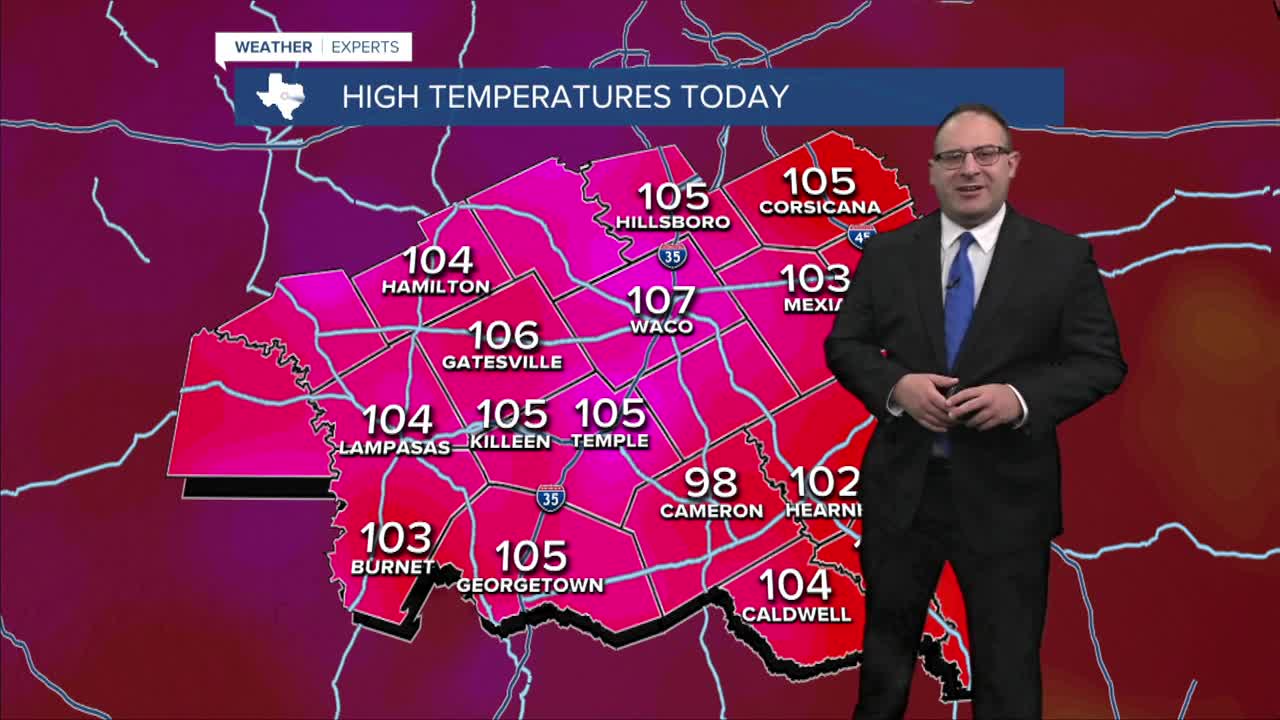


CENTRAL TEXAS — Sunday's high temperature hit 107 in Waco which tied the record high for today. At 107, that is also the hottest day of the whole year. Surprising to see this level of heat in Late-August instead of our usual hottest time frame of the year which is late-July and early-August.
Sunday also marks the 21st day in a row at 100 degrees and above.
Monday will remain around 105-107 degrees. Heat Index around 108-110. The National Weather Service has expanded Extreme Heat Warnings to include all of Central Texas which the exception of the Brazos Valley for Monday.
Tuesday to Friday will be more humid, meaning the high temperatures will be around 101 to 104 with the heat index around 110. That plus the longevity of this heat streak could probably prompt an upgrade to Extreme Heat Warnings from the National Weather Service.
Another weak summer cold front could throw some nearby pop-up storms on Thursday for Central Texas and Friday for the Brazos Valley. Most computer models doubled-down on the rain chances, so I've optimistically increased the odds to 20-30%. If we're gonna get any heat relief, it's gotta be from rain and clouds, not just wannabe cold fronts.
- 25 News Meteorologist Thomas Patrick
Want this forecast delivered to your inbox each morning? Sign up for the daily forecast email newsletter here.
