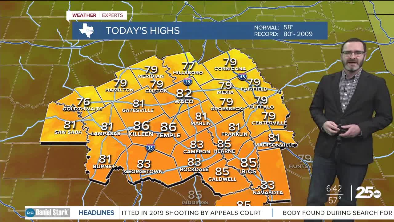


CENTRAL TEXAS — Highs will climb into the low to mid 80s this afternoon with westerly winds bringing in warmer air. Another cold front is on the way overnight that will bring cooler conditions for Saturday.
THE BREAKDOWN:
- Record heat today with highs in the low to mid 80s.
- Westerly winds keep Cedar pollen around.
- Slight cool-down into tomorrow.
- Warm to start next week but rain chances looming.
Good morning! We are kicking off the morning with temperatures in the 50s and the 60s. That's where we should be in the afternoon this time of year. That warm start will propel us to a warm finish as southwest winds push us into the 80s this afternoon. Westerly winds will also grab Cedar pollen as they near 20mph at times. If you are a Cedar sufferer, you need to start the meds early today. A cold front will move in overnight into tomorrow, and, while it won't be very cold behind it, we will see numbers return closer to where they should be in the afternoon for Saturday in the 60s. Sunday starts off chilly in the 30s, but may reach 70s in the afternoon.
Our upper-level ridge will return temperatures to the 70s and 80s for the first half of next week, but the pattern should shift allowing for storm chances for the second half of the week and potentially a stronger cold front by the weekend.
Have a great Friday!
Meteorologist Josh Johns
25 Weather
Want this forecast delivered to your inbox each morning? Sign up for the daily forecast email newsletter here.
