

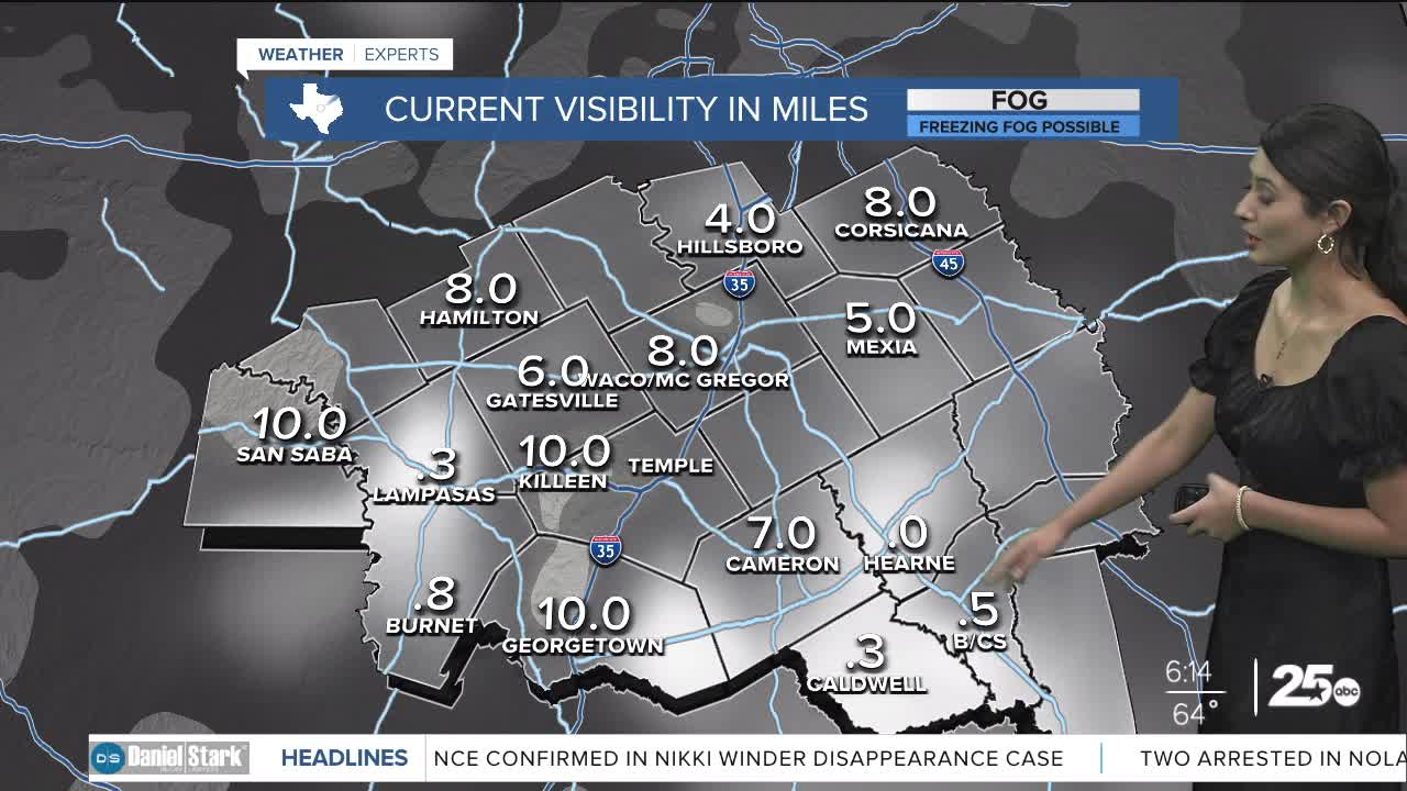


CENTRAL TEXAS — Central Texans are waking up to areas of patchy fog near the I-35 corridor and eastern counties. The fog in the Brazos Valley will create lower visibility after sunrise then begin to clear out.
The changes today look to have warmer temperatures and slightly more humid conditions as the dew points creep closer to the 70s. High temperatures will rise to the upper 80s and the feels like temperature will hit above 90. The models are showing dry conditions today, but with the humidity and heat rising, we cannot rule out a pop-up thunderstorm, albeit the chances remain very low.
Heading into the three day weekend the temperatures will hover in the low 90s. It will be hot and humid and feel more like the mid to upper 90s at the hottest part of the day. Remember to dress in breathable clothing for outdoor activities and to stay hydrated. Rain chances remain very low so I would keep any outdoor plans in tact. Conditions should make for a very warm weekend at the lakes, to end the month of May.
The next best rain chances arrive next week as we step into the month of June and inch closer to the sweltering summers of central Texas. We could begin to see some scattered showers the beginning of the work week.
Want this forecast delivered to your inbox each morning? Sign up for the daily forecast email newsletter here.
