

CENTRAL TEXAS — Highs will climb into the upper 90s this afternoon with the humidity making things feel closer to the triple digits. A cold front arrives tomorrow bringing rain chances up.
THE BREAKDOWN:
- Highs climb into the upper 90s today.
- Isolated storms may drop into our northwestern areas from the Big Country this evening.
- Better storm chances with cold front arrival tomorrow.
- Little bit of a "fall-like" feel for the second half of the week.
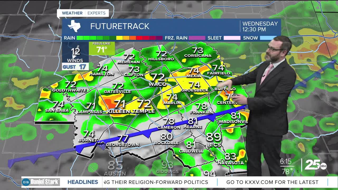
Good morning! We're starting off humid here in Central Texas with lows in the upper 70s. Get ready for another summer-like day with highs climbing into the upper 90s. With the humidity, it may feel more like the triple digits. All of this is in advance of our next cold front that's in the Panhandle currently. As it drops into West Texas this afternoon, we may see a few showers and storms fire up closer to the I-20 corridor. Some of those could drop into our northwestern counties this evening. If that happens, the main threat will be hail and wind.
The cold front should slide into our area during the morning hours tomorrow. Expect scatttered showers and storms along the front and potentially behind it. Since they will be mainly in the first part of the day, I don't expect big issues with severe weather. There's some question marks regarding how widespread the activity, and how heavy the rain will be. Most models have this activity dying as it moves in, and refiring on the cold front south of Waco-Temple-Killeen in the afternoon. If that happens, totals will be rather light. Our in-house model actually ramps up the activity, which would lead to higher totals, potentially more than an inch or two. We will watch the trends this afternoon.
Behind the cold front, drier, more fall-like air will work in with highs in the upper 80s and morning lows in the low 60s!
Have a great Tuesday and stay cool!
Meteorologist Josh Johns
25 Weather
