

25 EVENING WEATHER — The weekend is here, and scattered shower and storm potential will continue. Tonight, any showers and storms will die out after sunset with lows in the mid 60s.
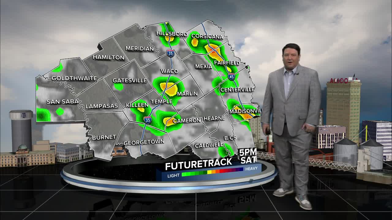
Saturday will bring another chance of afternoon and evening scattered activity, but the best chance of strong storms will be in west Texas late Saturday afternoon and evening. Highs will make it into the low 80s.
Sunday is a day to watch. Right now, it looks like a line of showers and storms will form in west Texas and push east into our area Sunday morning. Storms should weaken as they move into Central Texas, but some stronger wind gusts and locally heavy rain will be possible. The big question is...will the morning storms disrupt the atmosphere enough to prevent much in the way of storm activity Sunday afternoon and evening? This is a wait and see at this point. The ingredients for severe weather will be around. I think if we see widespread morning storms, that will limit the amount of severe weather we will see Sunday afternoon. If we don't see many storms Sunday morning, then that could spell a better chance of severe weather Sunday afternoon.
Next week, we may see a few showers and storms from time to time, but the best chances could be northwest of our area. Right now, it looks like the best chance of storms will be by the middle part of the week and again next weekend as a cold front gets closer to the region. Highs will be in the 80s with lows in the 60s.
Have a great weekend!
Want this forecast delivered to your inbox each morning? Sign up for the daily forecast email newsletter here.
