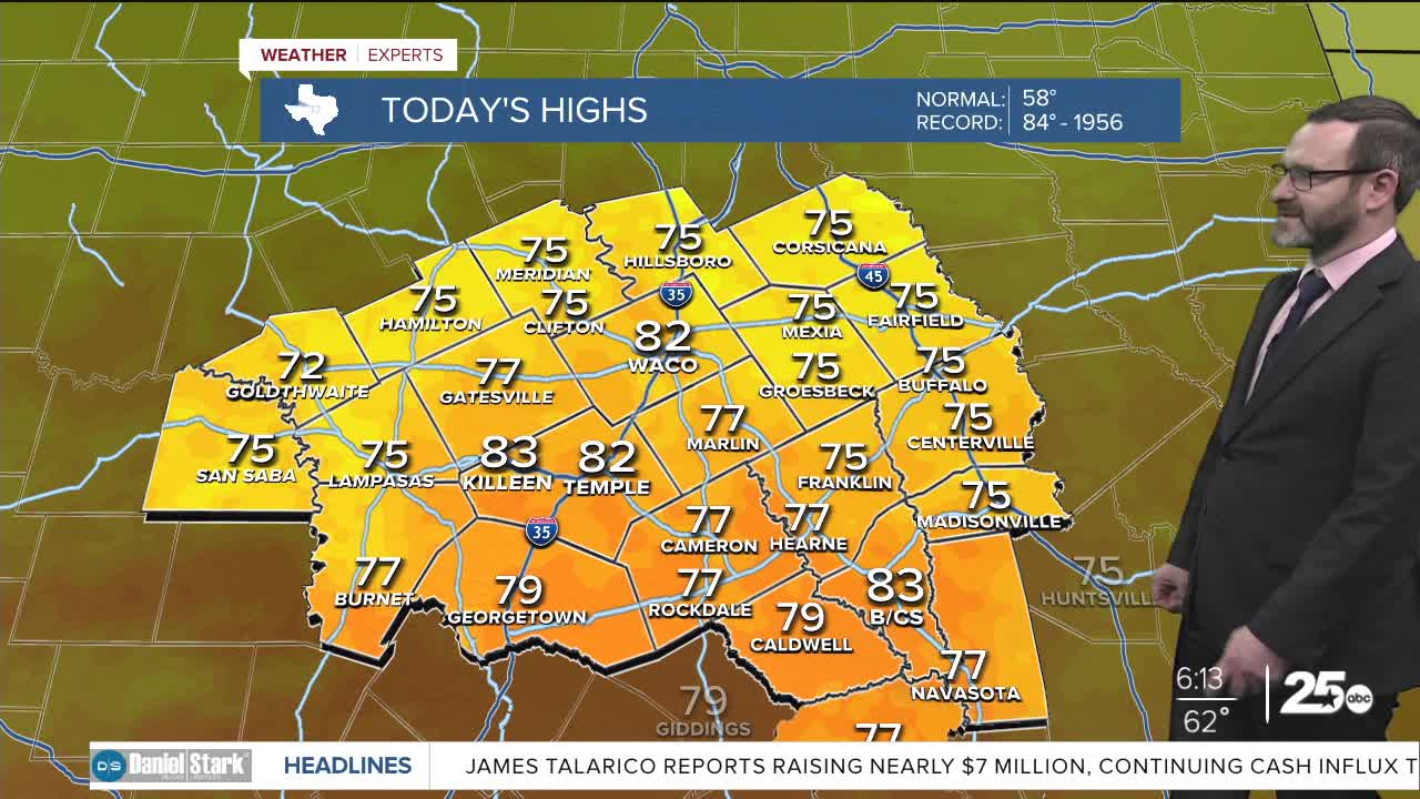


CENTRAL TEXAS — Highs will climb into the low 80s this afternoon, with the potential for record-breaking heat. A weak cold front will bring a cooler morning Wednesday.
THE BREAKDOWN:
- Near-record heat likely again today.
- Small rain chances to end the week.
- Stronger cold front brings weekend cool-down.
- Staying cool next week.
Good morning! We're waking up to a humid morning across Central Texas with morning lows in the 60s and 70s. We'll see westerly winds help clear things out today, pushing our temperatures into the low 80s. We may stay just shy of the record of 84, but not by much. A weak frontal boundary passes through and that will bring drier air for tonight allowing lows to fall into the 40s and 50s. South winds quickly take back over tomorrow pushing our highs back near 80.
Our next storm system swings overhead to end the week and could bring small rain chances Thursday and Friday before a stronger cold front knocks our highs into the 50s for the weekend. A couple of freezes may happen Sunday or Monday morning with a cooler pattern in place next week keeping our highs in the 60s.
Have a great Tuesday!
Meteorologist Josh Johns
25 Weather
Want this forecast delivered to your inbox each morning? Sign up for the daily forecast email newsletter here.
