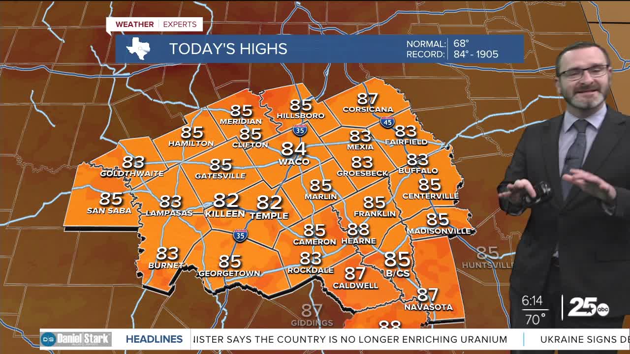


CENTRAL TEXAS — Highs will climb into the mid 80s this afternoon with clouds hanging around longer. That will still be near record levels. Storm chances arrive starting tomorrow.
THE BREAKDOWN:
- Near-record highs possible again today.
- Storm chances begin Wednesday but really ramp up Thursday.
- Potential for 1-2 inches with some 3 inch totals.
- Another round of rain early next week.
Good morning! We're waking up to another humid start across Central Texas as we start in the 70s. Clouds will hang around a little longer today, breaking at times in the afternoon. Because of that cloud cover, it won't get as warm, only climbing into the mid 80s. The irony is that's still near record levels, with the possibility to tie or break a 120 year old record high today!
Rain chances start Wednesday as our next weather-maker rolls towards Texas. That will lead to some scattered showers and storms Wednesday with more widespread activity expected Thursday. While we will still have to watch for a few strong storms Thursday, the severe threat looks rather low. Some heavy rain will be possible, so flooding potential will have to be monitored. Rain chances will taper through the day Friday. Total rainfall amounts of 1-2 inches are expected, with a few 3 inch totals possible.
Things look quiet Saturday with highs near 70 and morning lows in the low 50s. We'll see another storm system move in early next week bringing another couple inches of rain possible Monday into Tuesday. Rain chances may linger into Thanksgiving with a stronger cold front on the way!
Have a great Tuesday!
Meteorologist Josh Johns
25 Weather
