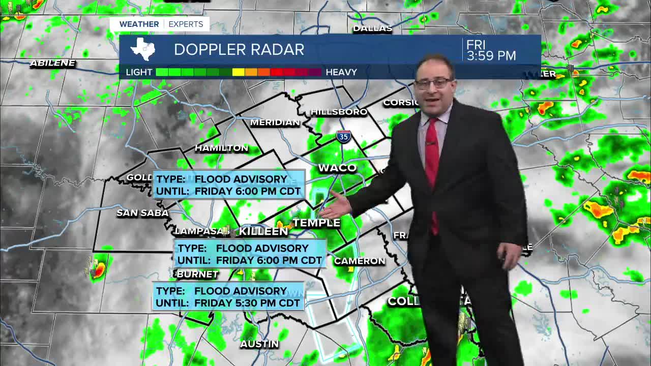


CENTRAL TEXAS — The pop-up scattered showers and thunderstorms today have been slow moving and packed with heavy rain. With upwards of 3" of rain per-storm possible, Flood Advisories have been issued for areas that are being specifically hit by the current storms. Here's a breakdown of the current advisories:
Flash Flash Warning for Williamson and Burnet Counties until 10pm. This is for areas near Liberty Hill to Briggs, west of I-35. Doppler radar estimates as much as 4" of rain has fallen near and south of Briggs. The storms is barely crawling northwards towards Copperas Cove and will be monitored for more regions that could experience flooding issues.
Flood Watch for Williamson and Burnet Counties goes until 1am Saturday, this is part of a larger area that includes Austin and San Antonio. All the storms in this region have been pumping out 1-4" of rain per storm so far tonight.
With humidity and precipitable water levels sky high today, any showers and storms will continue to be heavy rain makers. This will mainly affect flood prone areas rurally and poor drainage areas in urban centers. A few heavy showers may continue past midnight tonight for Central Texas and the Brazos Valley.
Then on Saturday, a storm center over West Texas will likely fire up new thunderstorms. This means more scattered pop-up thunderstorms for Central Texas in the morning - afternoon - and evening. The heaviest and strongest storms will affect areas to the west and northwest, including Abilene, Wichita Falls, and Fort Worth. No severe weather expected for Central Texas.
Sunday it's back to more pop-up thunderstorms before the stormy weather pattern settles down into a dry and hot pattern for next week. High temperatures will be above average into the mid 90s for much of next week marking some of the hottest weather we've seen so far this season.
- 25 News Meteorologist Thomas Patrick
Want this forecast delivered to your inbox each morning? Sign up for the daily forecast email newsletter here.
