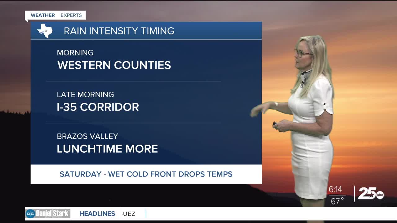


CENTRAL TEXAS — Central Texas is catching a break from dry conditions with the arrival of morning storms. It's a wet morning commute for most counties west of I-35.
There is a low opportunity for severe weather the counties of Lampasas, San Saba, Mills, Hamilton and Coryell for the early morning hours. The line of storms will continue to move east, and will struggle to maintain the same intensity. The southeaast corner of San Saba county has a flood advisory until 7:30 a.m.
The I-35 corridor will receive the most precipitation during the late morning. By lunchtime, the storms will be in the Brazos Valley. As move into the afternoon, most of Central Texas will be drying out, and remain mostly quiet, although a stray isolated shower can't be ruled out.
For Friday, a few light scattered showers may visit our area, but it will be mostly dry and warm with some cloud coverage. Saturday will bring a cold front and more widespread rain. Temperatures will finally leave the 80s and dip to the 70s on Saturday. Behind the front a deeper dip will bring high temperatures for Easter Sunday to the 60s. Most of the rain will occur on Saturday. Although a few scattered showers may linger into Sunday, Easter will mostly be a cloudy day with cool temps. Lows will dip to the 50s.
As move into Monday, a temperature climb returns for the work week. The trend of above average temperatures return to the forecast next week.
Want this forecast delivered to your inbox each morning? Sign up for the daily forecast email newsletter here.
