

CENTRAL TEXAS — Central Texans may be waking up a little extra tired today as they adjust to the work week time change. Sunrise kicks off a 7:45 a.m. With the sunrise coming an hour later, the thicker morning fog will dissipate closer to 9am. Williamson and Burnet counties are under dense fog advisories.
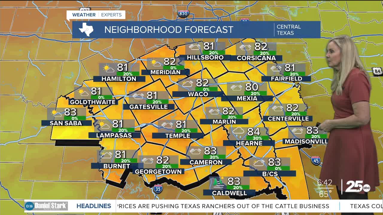
Monday will be mostly cloudy and breezy. Sustained winds will run between 15 and 20 mph. We may feel gusts up to 30 mph. The breeze will help make the humid and warm temperatures feel more comfortable. Highs are expected to reach the low 80s with a feels like temperature a few degrees higher due to the humidity.
On Tuesday afternoon, a system arrives that will return rain chances to our area. The front will give us a slight chance of severe weather on the western side of Central Texas, west of I-35. This set up will be similar to what we experienced Friday. Few storms are expected Tuesday afternoon, but if one can break through the warm layer of air above Central Texas, then we would see severe weather. Hail and strong winds would likely be the culprit, however a tornado can not be ruled out.
The majority of rain will fall overnight Tuesday into Wednesday's early afternoon. Temperatures drop behind the front for a couple days. Then we warm back up to the 80s for the weekend.
Want this forecast delivered to your inbox each morning? Sign up for the daily forecast email newsletter here.
