

CENTRAL TEXAS — Highs will climb into the low 90s Friday with partly cloudy skies. Rain chances will return Saturday with a cold front that will bring a more seasonable Sunday.
THE BREAKDOWN:
- Turning warm again Friday with highs in the low 90s.
- Cold front Saturday evening brings rain chances Saturday afternoon.
- More fall-like Sunday
Good morning! We're waking up to a bit more humidity and warmer conditions with morning lows in the mid 60s. Don't expect as much cloud cover Friday as sunshine will be more abundant. We'll see highs in the upper 80s and low 90s Friday with south breezes.
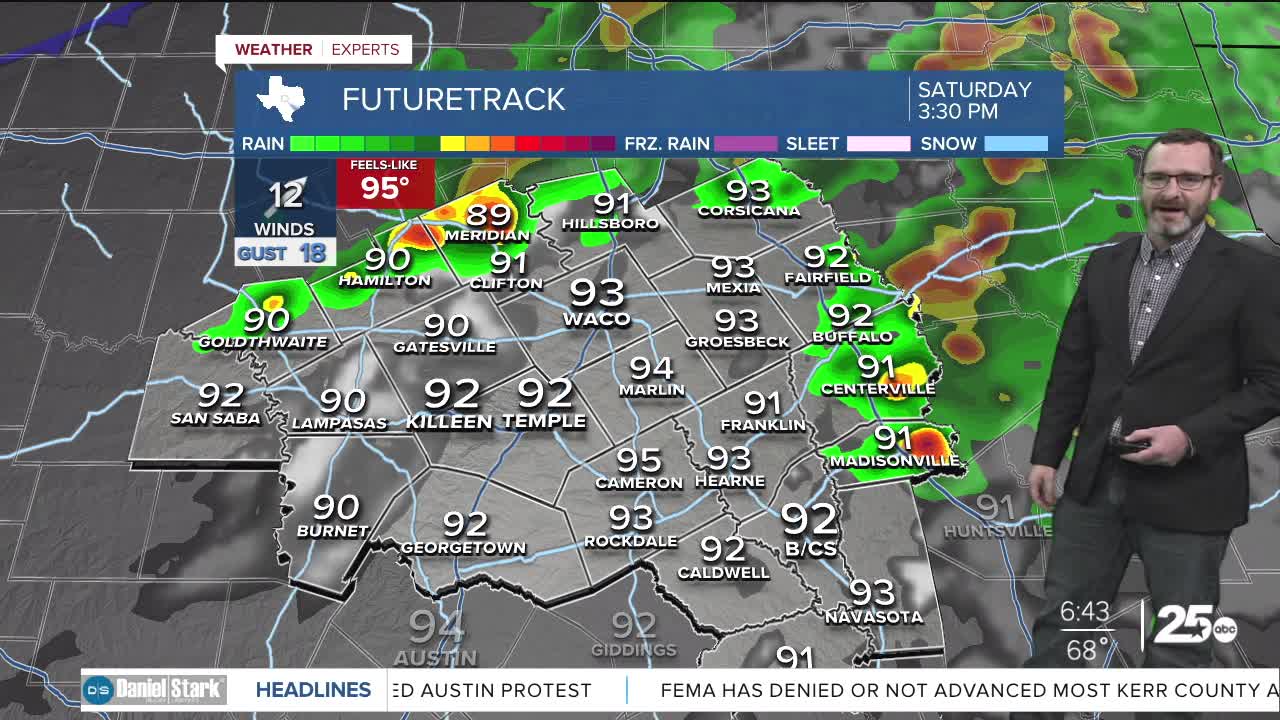
All of this is setting us up for changes for the weekend. A cold front will come in Saturday evening and ahead of it we should see highs warm into the low 90s. Showers and storms could develop during the midday hours along and east of I-35. These may turn strong if they can get going, with the threats being small hail and gusty winds as they move east of I-45. Further to the west, southwest winds could push highs into the mid 90s in spots. A few isolated showers and storms may be possible along the cold front in the evening, but most will miss out.
Behind the cold front, expect a BEAUTIFUL day Sunday with highs in the low to mid 80s and plenty of sunshine along with drier air! Monday could be cool to start, with morning lows in the mid 50s, but highs will rebound into the low 90s.
We'll have two more fronts next week, but they don't look to be strong, and only keep us in the mid 80s. A late week front could bring us better storm chances Thursday and Friday!
