

25 EVENING WEATHER — We are in the calm before the storm this week across Central Texas. Tonight will bring a few clouds with lows in the low 30s. Tuesday, clouds will increase with highs in the upper 50s and low 60s. Showers will be around Wednesday, but nothing looks too heavy. Highs Wednesday will climb into the low 60s.
Thursday will remain mostly cloudy with highs in the mid 60s. Then...HERE IT COMES!
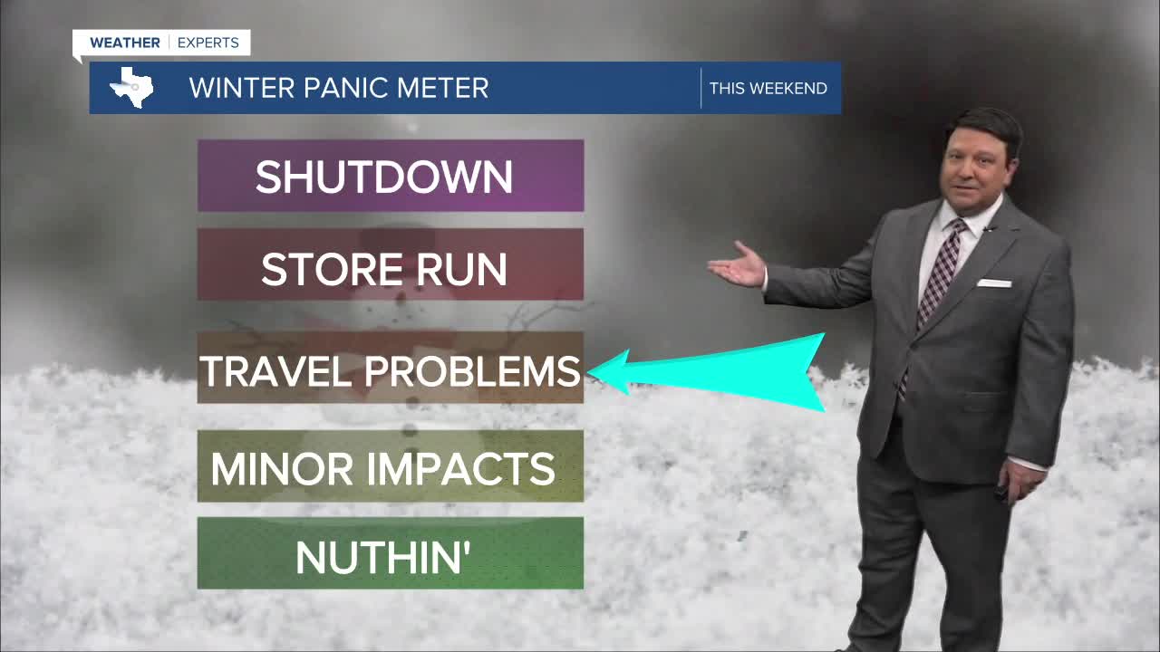
Friday, we should see cloudy skies with showers developing as we head into the afternoon hours. An arctic cold front will be racing through north Texas, and it should be here Friday evening. This will bring rapidly falling temperatures into the 30s Friday evening. Rain may begin to mix with or change to freezing rain across the northern half of the area before midnight. We all will change to a mix of freezing rain and sleet as we head into Saturday morning, including the Brazos Valley. Saturday looks cold with temperatures falling through the 20s with an on and off wintry mix of precipitation. This will likely linger into Sunday morning, but we should see precipitation taper off through the day Sunday, but it will remain cloudy. This will only allow highs to get into the low to mid 30s across the region.
Since it's Monday evening, there will likely be adjustments to the forecast, for worse or better, as we get closer to the weekend. This is not set in stone just yet. We are too far out to get to specific on ice and snow amounts. With that said, the models are in remarkable agreement for this far out, and it does appear we are in for some sort of winter event!
Want this forecast delivered to your inbox each morning? Sign up for the daily forecast email newsletter here.
