

CENTRAL TEXAS — Active weather pattern for Central Texas will stay in place from today through next Thursday. While the forecast will identify daily storms, some of those days will have much higher chances than others. Today, for example, will have scattered pop-up storms not unlike was the region saw on Thursday. Storms will have brief but heavy downpours. No severe weather expected.
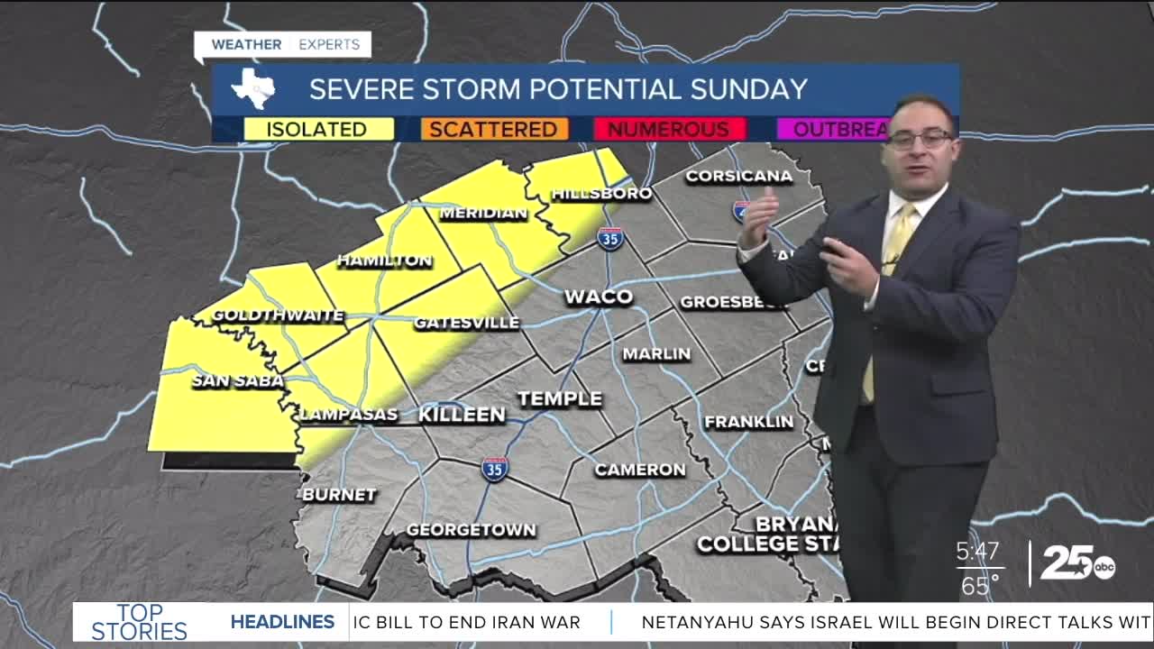
Saturday, a dryline will develop in West Texas and fire off severe weather there. Those storms are likely to propagate eastward towards Waco late Saturday evening. By the time they arrive, they'll be non-severe. But these storm could have a vast impact on severe weather chances Sunday... Should the rain and storms in the morning linger with extra cloud coverage, severe weather chances go way down for Central Texas. For now, modeling keep afternoon thunderstorms going for some, especially northwest of Waco, mainly Meridian to Abilene.
Next week, thunderstorm chances stay alive through Thursday. Things keep changing quite a bit especially for Tuesday and Wednesday's storm chances. My latest analysis keeps a bulk of the action well north of us. Oklahoma and the Central Plains states have better storm chances, with Waco on the southern tip of some severe storm chances. Bit to early to set anything in stone in this regard.
- 25 News Meteorologist Thomas Patrick
Want this forecast delivered to your inbox each morning? Sign up for the daily forecast email newsletter here.
