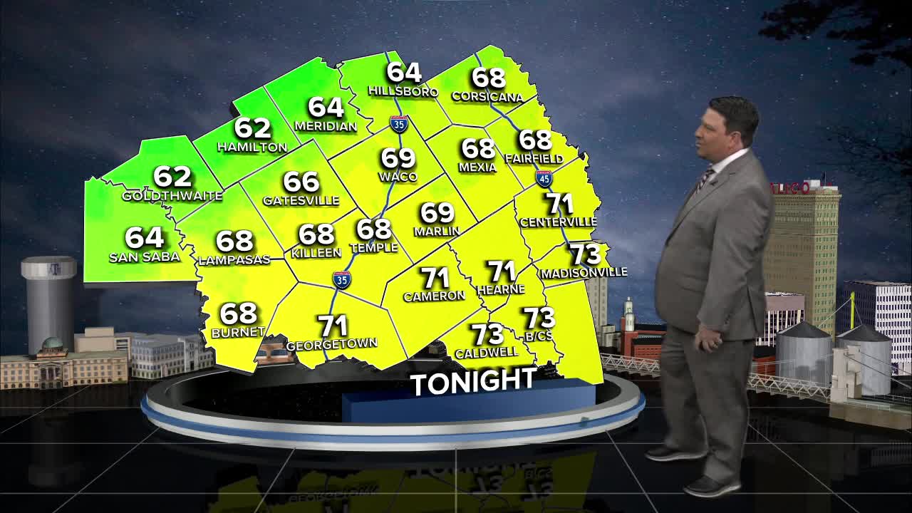


25 EVENING WEATHER — A complicated forecast is on tap for us over the next 24 hours. The main problem is a cold front that is moving south into Central Texas late tonight into tomorrow. Our hi-res models are now starting to pick up on a faster front Wednesday.
Highs ahead of the front are expected to be in the 70s and 80s, but we should fall into the 60s from north to south during the day. A few showers and storms are possible as the front moves through, but rain chances are only 30%. If a storm develops, one or two could become strong with pocket change size hail and gusty winds.
Thursday, an isolated shower or two will be possible with highs staying below normal in the low to mid 70s. We should start to warm up Friday as highs return to the low 80s with an isolated storm or two possible.
This weekend, a few storms can't be ruled out, but it will not be a washout. Saturday looks warm with highs in the mid 80s. A pop up storm or two will be possible during the afternoon and evening hours. Mother's Day Sunday, scattered showers and storms are possible during the afternoon and evening hours. These will occur as another cold front enters the area. Highs are expected to be in the mid to upper 80s ahead of the front, but we should fall into the 60s and 70s once the front blows through the area.
Want this forecast delivered to your inbox each morning? Sign up for the daily forecast email newsletter here.
