

CENTRAL TEXAS — Finally a decent chance for rain! February was a very dry month for Central Texas. Considering we remain in a drought, we are certainly thankful to kick off the first week of March with rain in the forecast, beginning Wednesday and lasting into next week.
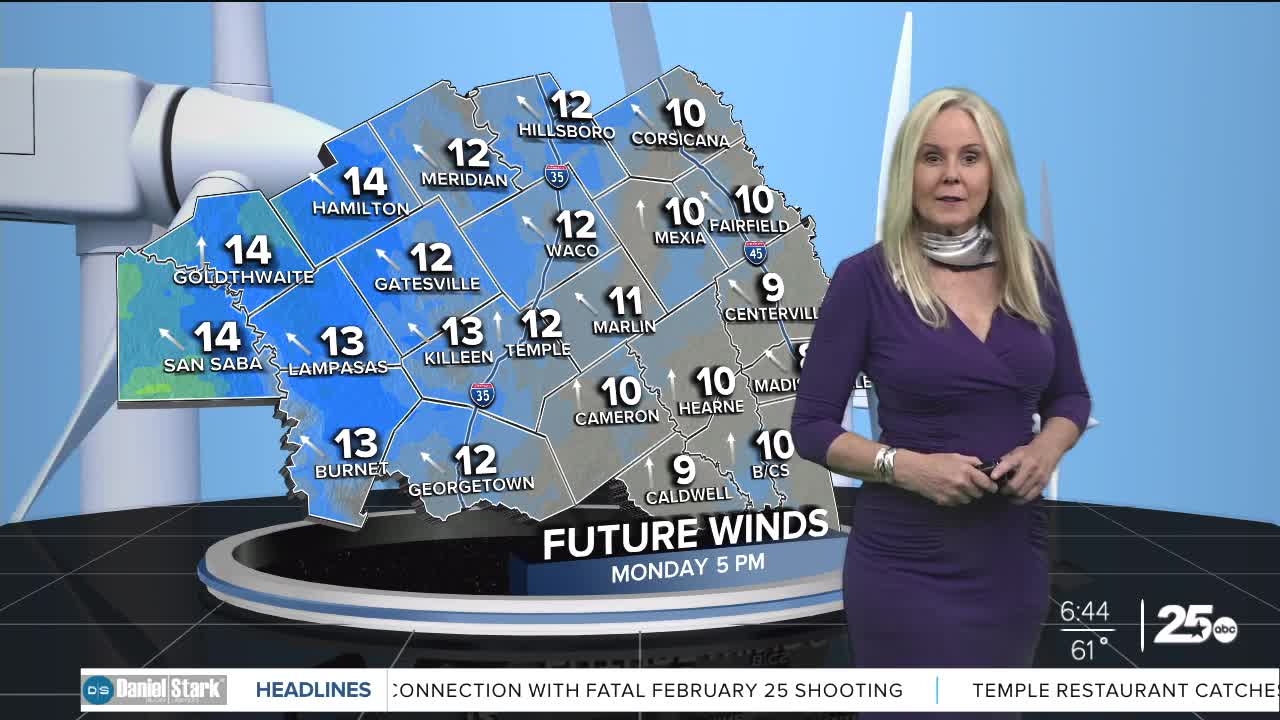
It is best to plan any outdoor errands or activities on Monday or Tuesday as those will be our driest days. A breeze is on tap for beginning of the week with a southerly wind helping warm up the atmosphere. On Tuesday, expect winds to increase to 20 mph with gusts up to 30 mph. Temperatures will remain above average and warm all week despite rain entering the forecast mid week.
By Wednesday, those much needed rain chances return with a decent opportunity of widespread showers beginning later in the day. There is a slight possibility of severe weather in the northern and western counties of Central Texas. The Storm Prediction Center has given it a Level 2 risk. These strong storms could produce hail and high winds.
On Friday our chances for strong storms dip further south. Thursday and Friday may be a situation where we see isolated storms come through but widespread rain is left out. At this point, the models are showing our best opportunity for the most rain will be Saturday and Sunday.
Central Texans should keep up with the forecast as the potential for severe weather is possible beginning mid week. Precipitation is likely going to be a round-robin situation beginning Wednesday and culminating mid next week.
Want this forecast delivered to your inbox each morning? Sign up for the daily forecast email newsletter here.
