


CENTRAL TEXAS — Our weather pattern for this weekend stands on a knife's edge between a summer-like hot, and a threat for large hail and thunderstorms.
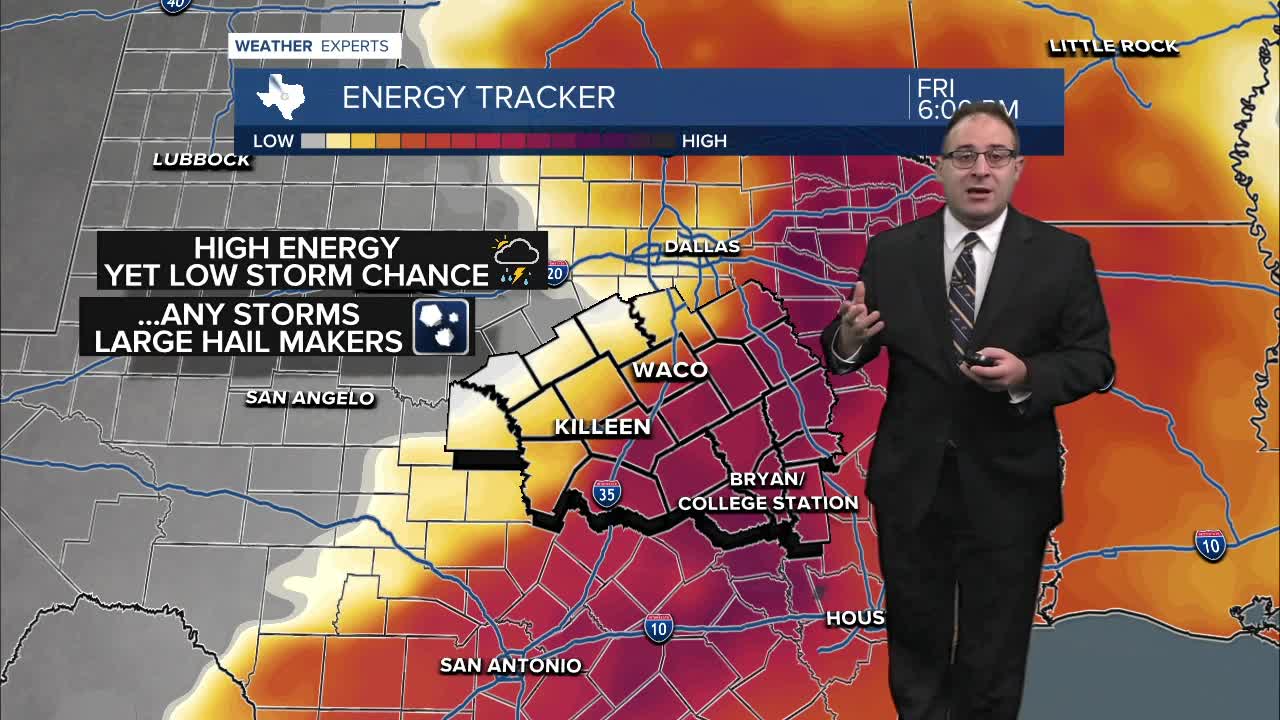
High energy levels in the atmosphere are in place over Central Texas... but there's no spark to ignite this into thunderstorms. Because of that, the overall thunderstorms chances are very low, between 5-20%. But what's concerning is the worst-case scenario among that 5% chance. Should a single storm arise, it would likely be a large hail producing thunderstorm. The high-end threat would be tennis ball size hail which is serious enough to call for a severe weather threat despite the low odds.
A powerful cold front over Oklahoma created severe weather and tornadoes on Thursday, and it's doing the same today. A Tornado Watch is in effect for regions southeast of Oklahoma City until 9pm tonight. These storms will likely stay north of Dallas and then continue southward, east of I-45, into the night. This should not affect Central Texas. Instead a dry line over San Angelo would be the "spark" for thunderstorms for us. However, the dry line isn't all that strong, with humidity already dropping ahead of that line through US-281. This means there's already less fuel for storms in that region in the first place. All this to say there's many limiting factors for thunderstorm formation tonight for Central Texas.
Saturday and Sunday will be about the same. Low chance for storms - high hail threat if any manage to fire up. Temperatures will be around 90 degrees both weekend days, and with dew points in the 70s. Hot, humid, and hazy! Don't cancel any outdoor plans. Prepare for summer temperatures and keep a watchful eye out for thunderstorms in case one does pop-up. I (Thomas Patrick), will be monitoring things from the 25 News weather central all weekend just the same.
Next week starts hot. More upper 80s and low 90s for Central Texas. More 10-20% chance for storms most days but the severe weather threat is unclear at this time. We'll see a big temperature drop between Thursday and Friday with highs dropping to the low 70s and possibly upper 60s to finish the work week. The following weekend, May 2-3, appears to be spectacular weather wise!
- 25 News Meteorologist Thomas Patrick
Want this forecast delivered to your inbox each morning? Sign up for the daily forecast email newsletter here.
