

CENTRAL TEXAS — Leprechauns are grabbing their jackets Tuesday morning as a freeze warning stretches across Central Texas until 9 a.m. The only counties exempt are Burnet and Williamson. A record low of 26 degrees has already hit the books. The last record was 30 degrees in 2005. That record may dip further as we get closer to sunrise.
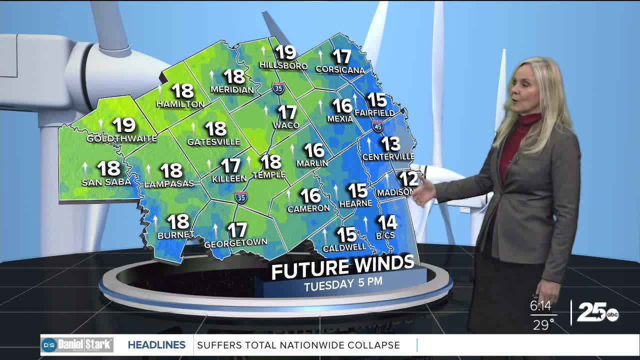
The positive news this morning is the lack of wind power. The low and high pressure systems that were sandwiching Central Texas have separated significantly. This has created space between the pressure gradients and eased the wind speeds. Today we will have an occasional light breeze, with a southerly flow of around 15 mph this afternoon.
It will switch from a cold wake-up, to a cool, dry and sunny afternoon. Temperatures will begin to rise after the sun appears. High temperatures will reach the mid to upper 60s.
With dew points in the teens and 20s, the fire danger remains an issue. However, with the lower winds, we are looking slightly more positive than Monday. Central Texas primarily has a very high to high threat with some spots of extreme danger near Gatesville. Open flames should be avoided.
Wednesday morning will be warmer with lows in the 40s. We will rise to the 70s Wednesday afternoon. As high pressure builds and settles in the southwest, our skies will remain mostly sunny as we move into the weekend. Temperatures will continue to climb each day, culminating with a hot weekend as highs soar into the low 90s. There is no rain in the forecast.
Want this forecast delivered to your inbox each morning? Sign up for the daily forecast email newsletter here.
