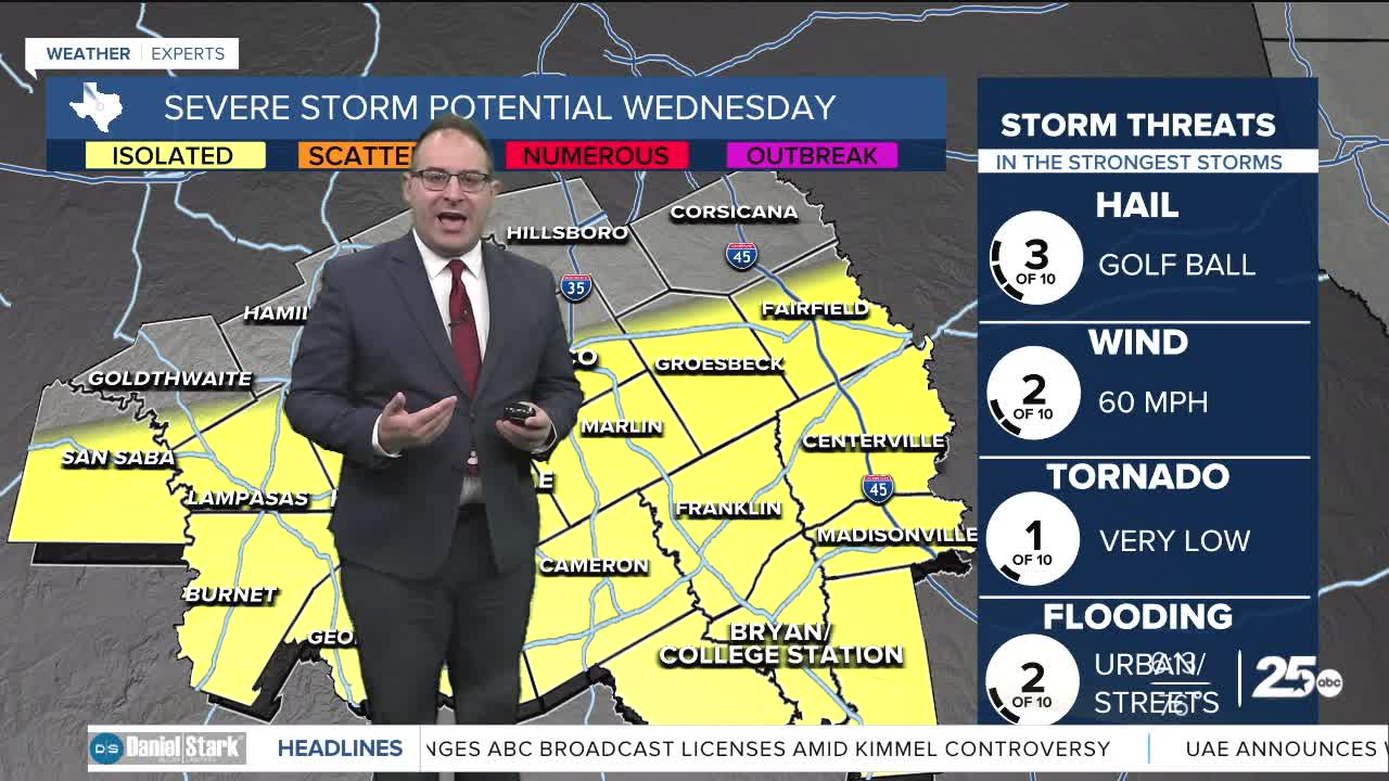


CENTRAL TEXAS — After covering severe thunderstorms Tuesday night, another round of thunderstorms are likely to fire up later this morning along the same cold front. That cold front is poised just north of Coryell and McClennan Counties as of 6am. You can tell the humidity is still high over the region with dew points in the 70s. Around 9-10am, new thunderstorms will form along that cold front likely near Gatesville, Waco, or southward. These late-morning storms are unlikely to be severe. Around 12pm to 2pm, thunderstorms will likely affect the Brazos Valley. At this time there's a slightly higher chance for storm or severe thunderstorms. Hail will be the primary risk again with any powerful thunderstorms.
The position of the cold front means there's a big high temperatures difference across Central Texas. Waco is currently in the mid 70s, and temps will dip into the upper 60s in the afternoon. Meanwhile at College Station, temps will rise to 80 degrees before any thunderstorms pass through.
The next storm system will be a big rain event for Central Texas. This will be between Thursday afternoon to Friday evening. Model indications are for up to 4" of rain to fall between today and Friday which is very well could lead to a flooding risk. Severe thunderstorms are unlikely because temperatures will be in the 60s during the rain event.
The weekend is looking extremely nice as temperatures recover to the upper 60s to mid 70s, but after the heavy rains the days prior there could be some water-logged or muddy conditions leftover.
- 25 News Meteorologist Thomas Patrick
Want this forecast delivered to your inbox each morning? Sign up for the daily forecast email newsletter here.
