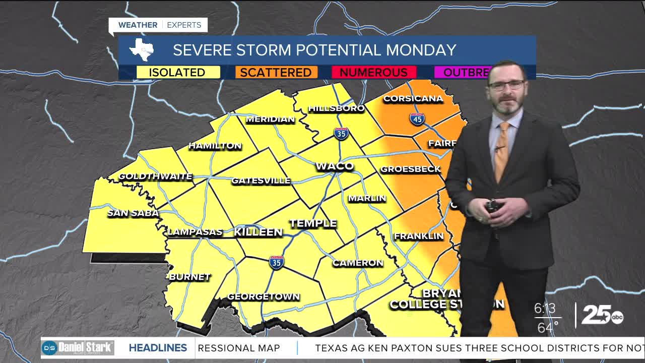


CENTRAL TEXAS — Storms will be possible through the day on Monday with the potential for some to turn strong to severe. The best chance for severe weather will be east of I-35, with all modes possible.
THE BREAKDOWN:
- Storms possible across Central Texas today.
- Some will be strong to severe.
- Threats: hail, wind, Isolated tornado (east of I-35)
- Turning cooler for the holiday.
Good morning! We're waking up to showers and storms across Central Texas as a complex that developed in West Texas overnight is moving in. Luckily, the timing of these arriving in the morning will tamper the severe weather threat. The line should weaken and break up as it works into the I-35 corridor. However, as temperatures warm east of I-35 and storms redevelop, they'll have the potential to turn into supercell storms. That means they will carry the potential to produce large hail, damaging winds, and an isolated tornado. The highest threat of this will be along I-45 and to the east into East Texas. Storms should transition from west to east as we head into the afternoon and evening with quieting weather overnight. A cold front will work in bringing temperatures down Tuesday, with a bigger cool-down by Wednesday. Highs will fall into the 60s with morning lows in the 30s and 40s for the holiday stretch.
Rain chances look to return this weekend as moisture works back in. While severe weather isn't expected, scattered showers and storms will be likely this weekend. At some point a strong cold front will come in into next week, bringing highs back down into the 50s. Models are struggling with the timing but December could start off chilly!
Have a great Monday and stay safe!
Meteorologist Josh Johns
25 Weather
